West Branch Community
Airport details
| Country | United States of America |
| State | Michigan |
| Region | K5 |
| Airspace | Minneapolis Ctr |
| Municipality | Horton Township |
| Elevation | 881ft (269m) |
| Timezone | GMT -5 |
| Coordinates | 44.24481, -84.17981 |
| Magnetic var | |
| Type | land |
| Available since | X-Plane v10.40 |
| ICAO code | Y31 |
| IATA code | n/a |
| FAA code | n/a |
Communication
| West Branch Community AWOS | 119.575 |
| West Branch Community CTAF | 122.800 |
Nearby Points of Interest:
Eggleston School
-Michigan Central Railroad Standish Depot
-Second Arenac County Courthouse
-Oscoda County Courthouse
-Alabaster Historic District
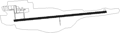
Runway info
| Runway 9 / 27 | ||
| length | 1521m (4990ft) | |
| bearing | 89° / 269° | |
| width | 30m (100ft) | |
| surface | asphalt | |
Nearby beacons
| code | identifier | dist | bearing | frequency |
|---|---|---|---|---|
| CGG | GRAYLING VOR | 35.2 | 309° | 109.80 |
| ASP | SABLE (OSCODA) DME | 35.8 | 75° | 116.10 |
| GYG | GRAYLING NDB | 41.1 | 308° | 359 |
| MBS | SAGINAW VOR/DME | 43 | 172° | 112.90 |
| MOP | MOUNT PLEASANT VOR/DME | 44.4 | 222° | 110.60 |
| MB | OLSTE (SAGINAW) NDB | 47 | 180° | 257 |
| AP | FELPS (ALPENA) NDB | 50.5 | 41° | 206 |
| GLR | GAYLORD VOR/DME | 51.2 | 326° | 109.20 |
| GL | BANGU (GAYLORD) NDB | 53.4 | 321° | 375 |
| APN | ALPENA VORTAC | 56.9 | 37° | 108.80 |
Instrument approach procedures
| runway | airway (heading) | route (dist, bearing) |
|---|---|---|
| RW09 | BANJO (358°) | BANJO RILOY (12mi, 280°) 3100ft NEWFE (5mi, 358°) 3100ft |
| RW09 | LADIN (97°) | LADIN HAPEV (21mi, 101°) 3300ft NEWFE (11mi, 101°) 3100ft |
| RW09 | ZABLE (168°) | ZABLE MILAE (23mi, 207°) 3100ft NEWFE (5mi, 178°) 3100ft |
| RNAV | NEWFE 3100ft KAKEW (6mi, 89°) 2600ft Y31 (6mi, 89°) 924ft AVIXY (11mi, 89°) SNOWW (9mi, 171°) BANJO (12mi, 272°) 4000ft BANJO (turn) | |
| RW27 | LADIN (97°) | LADIN AVIXY (54mi, 96°) 3300ft AVIXY (turn) 2500ft |
| RW27 | SNOWW (297°) | SNOWW AVIXY (9mi, 351°) 2500ft |
| RW27 | WHOOP (260°) | WHOOP AVIXY (5mi, 237°) 2500ft |
| RNAV | AVIXY 2500ft JAMAC (6mi, 269°) 2500ft HAXOV (3mi, 269°) 1500ft Y31 (2mi, 269°) 903ft (5155mi, 118°) 1300ft BANJO (5154mi, 298°) 4000ft BANJO (turn) 4000ft |
Disclaimer
The information on this website is not for real aviation. Use this data with the X-Plane flight simulator only! Data taken with kind consent from X-Plane 12 source code and data files. Content is subject to change without notice.