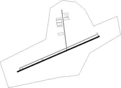
New Hudson - Oakland Southwest
Airport details
| Country | United States of America |
| State | Michigan |
| Region | K5 |
| Airspace | Cleveland Ctr |
| Municipality | Oakland County |
| Elevation | 924ft (282m) |
| Timezone | GMT -5 |
| Coordinates | 42.50312, -83.62372 |
| Magnetic var | |
| Type | land |
| Available since | X-Plane v10.40 |
| ICAO code | Y47 |
| IATA code | n/a |
| FAA code | Y47 |
Communication
| Oakland Southwest CTAF/UNICOM | 122.700 |
| Oakland Southwest DETROIT Approach/Departure | 127.500 |
Nearby Points of Interest:
Bingham House
-Hubbard-Kesby House
-Alonzo W. Olds House
-Dr. Henry K. Foote House
-North Milford Village Historic District
-Detroit Finnish Co-operative Summer Camp
-Nathan B. Devereaux Octagon House
-Salem Methodist Episcopal Church and Salem Walker Cemetery
-Milford Rural Agricultural School
-Kittie C. McCoy House
-Nardin Park United Methodist Church
-Western House (Brighton, Michigan)
-Northville Historic District
-Robert Yerkes House
-Ford Valve Plant
-Andrews-Leggett House
-Joseph D. Yerkes House
-Highland United Methodist Church
-August Westphal Farmstead
-Orson Everitt House
-Greenmead Farms
-Tivadar and Dorothy Balogh House
-St. Patrick's Parish Complex
-Henry W. Baker House
-Charles G. Curtiss Sr. House
Nearby beacons
| code | identifier | dist | bearing | frequency |
|---|---|---|---|---|
| SVM | SALEM VORTAC | 5.8 | 162° | 114.30 |
| PSI | DME | 12.5 | 25° | 111 |
| DXO | DETROIT VOR/DME | 20.8 | 138° | 113.40 |
| DT | REVUP (DETROIT) NDB | 24.5 | 153° | 388 |
| DM | SPENC (DETROIT) NDB | 25.2 | 124° | 223 |
| CRL | CARLETON VOR/DME | 28.3 | 160° | 115.70 |
| FNT | FLINT VORTAC | 28.3 | 345° | 116.90 |
| TCU | TECUMSEH NDB | 30.4 | 209° | 239 |
| RYS | GROSSE ILE (DETROIT) NDB | 31.9 | 130° | 419 |
| QG | WINDSOR NDB | 35.3 | 104° | 353 |
| MTC | SELFRIDGE (MOUNT CLEMENS) TACAN | 35.6 | 82° | 133.70 |
| JXN | DME | 39.8 | 254° | 115.45 |
| ADG | ADRIAN NDB | 43 | 216° | 278 |
| TOL | TOLEDO TACAN | 55.1 | 191° | 112.50 |
| TO | TOPHR (TOLEDO) NDB | 58.5 | 197° | 219 |
| ECK | PECK TACAN | 60.2 | 50° | 114 |
| MB | OLSTE (SAGINAW) NDB | 62.5 | 330° | 257 |
| PCW | PORT CLINTON NDB | 68 | 143° | 423 |
Disclaimer
The information on this website is not for real aviation. Use this data with the X-Plane flight simulator only! Data taken with kind consent from X-Plane 12 source code and data files. Content is subject to change without notice.