Ionia - Ionia Co
Airport details
| Country | United States of America |
| State | Michigan |
| Region | K5 |
| Airspace | Chicago Ctr |
| Municipality | Orange Township |
| Elevation | 816ft (249m) |
| Timezone | GMT -5 |
| Coordinates | 42.93793, -85.06057 |
| Magnetic var | |
| Type | land |
| Available since | X-Plane v10.40 |
| ICAO code | Y70 |
| IATA code | n/a |
| FAA code | Y70 |
Communication
| IONIA CO AWOS-3 | 118.900 |
| IONIA CO CTAF/UNICOM | 122.800 |
| IONIA CO LANSING Approach/Departure | 118.650 |
Nearby Points of Interest:
Ionia Downtown Commercial Historic District
-William H. VanderHeyden House
-Ionia County Courthouse
-Hall-Fowler Memorial Library
-Sessions Schoolhouse
-Muir Church of Christ
-Portland Downtown Historic District
-Portland School Apartments
-Portland First Congregational Church
-Alvah N. Belding Memorial Library
-Pere Marquette Railway Belding Depot
-Downtown Lowell Historic District
-North Country Trail
-St. John the Baptist Catholic Church Complex
-Greenville Downtown Historic District
-First Congregational Church
-Barry County Courthouse
-Daniel Striker House
-Shriner-Ketcham House
-Stony Creek Bridge
-Giles Gilbert House
-Union School
-Lansing Civil Air Patrol Quonset Huts
-Giles J. Gibbs Building
-John Carveth House
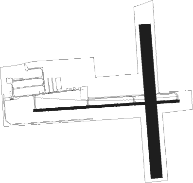
Runway info
Runway 9 / 27  | ||
| length | 1307m (4288ft) | |
| bearing | 90° / 270° | |
| width | 23m (75ft) | |
| surface | asphalt | |
| Runway 18 / 36 | ||
| length | 1300m (4265ft) | |
| bearing | 180° / 0° | |
| width | 104m (340ft) | |
| surface | grass | |
Nearby beacons
| code | identifier | dist | bearing | frequency |
|---|---|---|---|---|
| GR | KNOBS (GRAND RAPIDS) NDB | 14.2 | 262° | 263 |
| VIO | VICTORY VOR/DME | 21.2 | 251° | 115.95 |
| BT | BATOL (BATTLE CREEK) NDB | 35 | 192° | 272 |
| MOP | MOUNT PLEASANT VOR/DME | 43.4 | 25° | 110.60 |
| MKG | MUSKEGON TACAN | 45.1 | 283° | 115.20 |
| AZO | KALAMAZOO VOR/DME | 47.3 | 215° | 109 |
| HIC | WHITE CLOUD VOR/DME | 47.8 | 314° | 117.60 |
| JXN | DME | 48.6 | 138° | 115.45 |
| MB | OLSTE (SAGINAW) NDB | 49.7 | 59° | 257 |
| AZ | AUSTN (KALAMAZOO) NDB | 52.7 | 210° | 371 |
| LFD | LITCHFIELD VOR/DME | 54.1 | 161° | 111.20 |
| MBS | SAGINAW VOR/DME | 55.8 | 59° | 112.90 |
Instrument approach procedures
| runway | airway (heading) | route (dist, bearing) |
|---|---|---|
| RW10 | BLBBY (70°) | BLBBY IJHUH (15mi, 52°) 3000ft |
| RW10 | IJHUH (90°) | IJHUH 3000ft |
| RW10 | WALKS (98°) | WALKS IJHUH (11mi, 106°) 3000ft |
| RNAV | IJHUH 3000ft ACNOP (6mi, 90°) 2500ft Y70 (5mi, 90°) 854ft (5188mi, 117°) 1064ft IJPUR (5178mi, 297°) 3000ft IJPUR (turn) | |
| RW28 | IJPUR (271°) | IJPUR 3000ft |
| RW28 | LUJOJ (241°) | LUJOJ IJPUR (8mi, 181°) 3000ft |
| RW28 | OBKUW (300°) | OBKUW IJPUR (8mi, 1°) 3000ft |
| RNAV | IJPUR 3000ft ERXUT (5mi, 271°) 2500ft Y70 (5mi, 271°) 842ft (5188mi, 117°) 1218ft IJHUH (5199mi, 297°) 3000ft IJHUH (turn) |
Disclaimer
The information on this website is not for real aviation. Use this data with the X-Plane flight simulator only! Data taken with kind consent from X-Plane 12 source code and data files. Content is subject to change without notice.