Onaway - Leo E. Goetz County
Airport details
| Country | United States of America |
| State | Michigan |
| Region | |
| Airspace | Minneapolis Ctr |
| Municipality | North Allis Township |
| Elevation | 830ft (253m) |
| Timezone | GMT -5 |
| Coordinates | 45.37085, -84.22501 |
| Magnetic var | |
| Type | land |
| Available since | X-Plane v10.40 |
| ICAO code | Y96 |
| IATA code | n/a |
| FAA code | Y96 |
Communication
| Leo E. Goetz County CTAF | 122.900 |
Nearby Points of Interest:
Presque Isle County Courthouse
-Radka-Bradley House
-Newton–Allaire House
-Faunce-McMichael Farm
-Johannesburg Manufacturing Company Store
-Frank A. and Rae E. Harris Kramer House
-James A. and Lottie J.
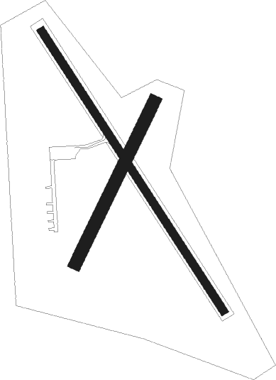
Runway info
Runway 15 / 33  | ||
| length | 793m (2602ft) | |
| bearing | 142° / 322° | |
| width | 18m (60ft) | |
| surface | asphalt | |
| Runway 03 / 21 | ||
| length | 428m (1404ft) | |
| bearing | 40° / 220° | |
| width | 30m (100ft) | |
| surface | grass | |
Nearby beacons
| code | identifier | dist | bearing | frequency |
|---|---|---|---|---|
| PLN | PELLSTON VORTAC | 24.1 | 301° | 111.80 |
| GLR | GAYLORD VOR/DME | 29.5 | 233° | 109.20 |
| GL | BANGU (GAYLORD) NDB | 32.6 | 239° | 375 |
| APN | ALPENA VORTAC | 33.1 | 113° | 108.80 |
| AP | FELPS (ALPENA) NDB | 37.4 | 122° | 206 |
| GYG | GRAYLING NDB | 45.2 | 224° | 359 |
| CGG | GRAYLING VOR | 46.5 | 216° | 109.80 |
| CI | KOLOE (SAULT STE MARIE) NDB | 59.2 | 342° | 400 |
| ASP | SABLE (OSCODA) DME | 65.6 | 138° | 116.10 |
Disclaimer
The information on this website is not for real aviation. Use this data with the X-Plane flight simulator only! Data taken with kind consent from X-Plane 12 source code and data files. Content is subject to change without notice.