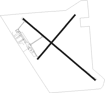
Albany
Airport details
| Country | Australia |
| State | Western Australia |
| Region | YM |
| Airspace | Melbourne Ctr |
| Municipality | City Of Albany |
| Elevation | 231ft (70m) |
| Timezone | GMT +8 |
| Coordinates | -34.94333, 117.80889 |
| Magnetic var | |
| Type | land |
| Available since | X-Plane v10.30 |
| ICAO code | YABA |
| IATA code | ALH |
| FAA code | n/a |
Communication
| Albany CTAF | 127.850 |
Nearby Points of Interest:
Camfield House
-The Rocks
-Dog Rock
-Pyrmont
-Patrick Taylor Cottage
-Albany Cottage Hospital
-Memorial Park Cemetery
-St John's Anglican Church, Albany
-Wesley Church, Albany
-Albany Courthouse
-Albany Club
-Albany House
-Empire Buildings
-Residency Museum
-Western Australian Bank, Albany Branch
-Stirling Terrace
-Vancouver House
-Drew Robinson & Company building (82-84 Stirling Terrace)
-Albany Masonic Hall
-Jubilee Bandstand
-Glasgow House
-Royal George Hotel, Albany
-Everett Buildings
-Albany Post Office
-Point King Lighthouse
Nearby beacons
| code | identifier | dist | bearing | frequency |
|---|---|---|---|---|
| ABA | DME-ILS | 0.4 | 172° | 109.70 |
| ABA | ALBANY NDB | 0.5 | 170° | 240 |
Instrument approach procedures
| runway | airway (heading) | route (dist, bearing) |
|---|---|---|
| RW14-Z | ALHWA (110°) | ALHWA 3300ft ALHWI (5mi, 68°) 3300ft |
| RW14-Z | ALHWB (129°) | ALHWB 3300ft ALHWI (5mi, 129°) 3300ft |
| RW14-Z | ALHWC (150°) | ALHWC 3300ft ALHWI (5mi, 209°) 3300ft |
| RNAV | ALHWI 3300ft ALHWF (5mi, 129°) 2100ft YABA (6mi, 128°) 276ft ALHWH (3mi, 130°) (6757mi, 287°) 3300ft |
Disclaimer
The information on this website is not for real aviation. Use this data with the X-Plane flight simulator only! Data taken with kind consent from X-Plane 12 source code and data files. Content is subject to change without notice.

