Boort
Airport details
| Country | Australia |
| State | Victoria |
| Region | YM |
| Airspace | Melbourne Ctr |
| Municipality | Boort |
| Elevation | 291ft (89m) |
| Timezone | GMT +11 |
| Coordinates | -36.13624, 143.72212 |
| Magnetic var | |
| Type | land |
| Available since | X-Plane v10.40 |
| ICAO code | YBBT |
| IATA code | n/a |
| FAA code | n/a |
Communication
| Boort CTAF | 126.700 |
Nearby Points of Interest:
Wycheproof railway station
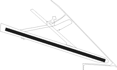
Runway info
| Runway 10 / 28 | ||
| length | 1082m (3550ft) | |
| bearing | 108° / 288° | |
| width | 30m (100ft) | |
| surface | grass | |
Nearby beacons
| code | identifier | dist | bearing | frequency |
|---|---|---|---|---|
| SWH | SWAN HILL NDB | 46.2 | 346° | 407 |
Disclaimer
The information on this website is not for real aviation. Use this data with the X-Plane flight simulator only! Data taken with kind consent from X-Plane 12 source code and data files. Content is subject to change without notice.