Benalla
Airport details
| Country | Australia |
| State | Victoria |
| Region | YM |
| Airspace | Melbourne Ctr |
| Municipality | Rural City of Benalla |
| Elevation | 566ft (173m) |
| Timezone | GMT +11 |
| Coordinates | -36.55416, 146.00917 |
| Magnetic var | |
| Type | land |
| Available since | X-Plane v10.40 |
| ICAO code | YBLA |
| IATA code | BLN |
| FAA code | n/a |
Communication
| Benalla CTAF | 122.500 |
Runway info
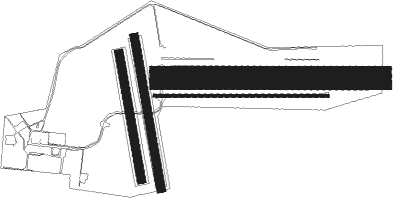
Runway 17 / 35  | ||
| length | 766m (2513ft) | |
| bearing | 173° / 353° | |
| width | 50m (164ft) | |
| surface | grass | |
| Runway 17L / 35R | ||
| length | 920m (3018ft) | |
| bearing | 173° / 353° | |
| width | 50m (164ft) | |
| surface | grass | |
| Runway 08 / 26 | ||
| length | 1043m (3422ft) | |
| bearing | 94° / 274° | |
| width | 18m (59ft) | |
| surface | asphalt | |
| Runway 08L / 26R | ||
| length | 1317m (4321ft) | |
| bearing | 94° / 274° | |
| width | 140m (459ft) | |
| surface | grass | |
Nearby beacons
| code | identifier | dist | bearing | frequency |
|---|---|---|---|---|
| SHT | SHEPPARTON NDB | 30.5 | 282° | 212 |
| COR | COROWA NDB | 37.9 | 32° | 380 |
| MNG | MANGALORE VOR | 43.9 | 248° | 113.20 |
| AY | ALBURY VOR/DME | 54.7 | 63° | 115.60 |
Instrument approach procedures
| runway | airway (heading) | route (dist, bearing) |
|---|---|---|
| RW26-Z | BLAED (256°) | BLAED 5000ft BLAEI (5mi, 209°) 3890ft |
| RW26-Z | BLAEE (273°) | BLAEE 5000ft BLAEI (5mi, 273°) 3890ft |
| RW26-Z | BLAEG (290°) | BLAEG 5000ft BLAEI (5mi, 341°) 3890ft |
| RNAV | BLAEI 3890ft BLAEF (5mi, 274°) 2300ft BLAEM (5mi, 274°) 705ft BLAEH (5mi, 274°) (7910mi, 284°) 3000ft |
Disclaimer
The information on this website is not for real aviation. Use this data with the X-Plane flight simulator only! Data taken with kind consent from X-Plane 12 source code and data files. Content is subject to change without notice.