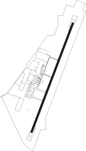
Bussleton - Busselton
Airport details
| Country | Australia |
| State | Western Australia |
| Region | YM |
| Airspace | Melbourne Ctr |
| Municipality | City Of Busselton |
| Elevation | 55ft (17m) |
| Timezone | GMT +8 |
| Coordinates | -33.68814, 115.39944 |
| Magnetic var | |
| Type | land |
| Available since | X-Plane v10.40 |
| ICAO code | YBLN |
| IATA code | BQB |
| FAA code | n/a |
Communication
| Busselton CTAF | 126.700 |
Nearby Points of Interest:
Busselton Jetty
-Ludlow
-Ellensbrook
-Anzac Park
-prince of wales hotel, bunbury
-Old Bunbury railway station
-Casuarina Point Lighthouse
-Wallcliffe House
-Southampton Homestead
Nearby beacons
| code | identifier | dist | bearing | frequency |
|---|---|---|---|---|
| BLN | BUSSELTON NDB | 0.3 | 225° | 386 |
Instrument approach procedures
| runway | airway (heading) | route (dist, bearing) |
|---|---|---|
| RW03-W | KAGIT (145°) | KAGIT 2400ft QB306 (4mi, 227°) PAGRI (3mi, 195°) QB304 (4mi, 160°) |
| RNAV | QB304 2400ft QB303 (3mi, 134°) 2400ft NULSO (5mi, 74°) YBLN (3mi, 27°) 106ft QB2SH (3mi, 28°) (6663mi, 286°) 2400ft | |
| RW03-X | AMVOB (279°) | AMVOB 2400ft QB206 (2mi, 278°) QB205 (3mi, 257°) QB204 (5mi, 235°) |
| RNAV | QB204 2400ft QB203 (3mi, 264°) 2400ft NULSO (5mi, 337°) YBLN (3mi, 27°) 106ft QB2SH (3mi, 28°) (6663mi, 286°) 2400ft | |
| RW03-Z | QB2SA (5°) | QB2SA 2400ft QB2SI (5mi, 310°) 2400ft |
| RW03-Z | QB2SB (29°) | QB2SB 2400ft QB2SI (5mi, 30°) 2400ft |
| RW03-Z | QB2SC (51°) | QB2SC 2400ft QB2SI (5mi, 95°) 2400ft |
| RNAV | QB2SI 2400ft QB2SF (5mi, 30°) 1700ft YBLN (6mi, 29°) 106ft QB2SH (3mi, 28°) (6663mi, 286°) 2400ft | |
| RW21-X | QB2NI (210°) | QB2NI 2400ft QB007 (2mi, 209°) |
| RNAV | QB007 2400ft QB006 (1mi, 174°) 2400ft QB005 (1mi, 174°) QB004 (2mi, 217°) QB003 (turn) QB002 (1mi, 233°) YBLN (2mi, 213°) 106ft QB2NH (3mi, 208°) (6659mi, 286°) 2400ft | |
| RW21-Z | QB2ND (186°) | QB2ND 2400ft QB2NI (5mi, 131°) 2400ft |
| RW21-Z | QB2NE (210°) | QB2NE 2400ft QB2NI (5mi, 210°) 2400ft |
| RW21-Z | QB2NG (232°) | QB2NG 2400ft QB2NI (5mi, 275°) 2400ft |
| RNAV | QB2NI 2400ft QB2NF (5mi, 210°) 1700ft YBLN (6mi, 211°) 106ft QB2NH (3mi, 208°) (6659mi, 286°) 1900ft |
Disclaimer
The information on this website is not for real aviation. Use this data with the X-Plane flight simulator only! Data taken with kind consent from X-Plane 12 source code and data files. Content is subject to change without notice.
