Ballarat
Airport details
| Country | Australia |
| State | Victoria |
| Region | YM |
| Airspace | Melbourne Ctr |
| Municipality | Ballarat |
| Elevation | 1433ft (437m) |
| Timezone | GMT +10 |
| Coordinates | -37.51167, 143.79111 |
| Magnetic var | |
| Type | land |
| Available since | X-Plane v10.40 |
| ICAO code | YBLT |
| IATA code | n/a |
| FAA code | n/a |
Communication
| Ballarat AWIS | 134.050 |
| Ballarat CTAF | 127.750 |
Nearby Points of Interest:
Ballarat City Fire Station
-Huyghue House
-Post Office Gallery
-Ballarat East Fire Station
-Ballarat Synagogue
-Victorian School of Forestry
-Buninyong Town Hall
-Glenmona Bridge
-Pitfield Bridge
-CFA Training College
-Meredith railway station
-Avoca railway station
-Lethbridge railway station
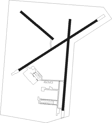
Runway info
Runway 18 / 36  | ||
| length | 1246m (4088ft) | |
| bearing | 191° / 11° | |
| width | 30m (98ft) | |
| surface | asphalt | |
| Runway 05 / 23 | ||
| length | 1266m (4154ft) | |
| bearing | 67° / 247° | |
| width | 30m (98ft) | |
| surface | asphalt | |
| Runway 13 / 31 | ||
| length | 569m (1867ft) | |
| bearing | 128° / 308° | |
| width | 30m (98ft) | |
| surface | grass | |
Nearby beacons
| code | identifier | dist | bearing | frequency |
|---|---|---|---|---|
| AV | AVALON VOR/DME | 45.2 | 129° | 116.10 |
Instrument approach procedures
| runway | airway (heading) | route (dist, bearing) |
|---|---|---|
| RW18-Z | BLZND (165°) | BLZND 4800ft BLZNI (5mi, 114°) 4660ft |
| RW18-Z | BLZNE (192°) | BLZNE 4800ft BLZNI (5mi, 191°) 4660ft |
| RW18-Z | BLZNG (217°) | BLZNG 4800ft BLZNI (5mi, 261°) 4660ft |
| RNAV | BLZNI 4660ft BLZNF (5mi, 191°) 3070ft BLZNM (5mi, 191°) 1476ft BLZNH (4mi, 191°) (7792mi, 285°) 4000ft | |
| RW36-Z | BLZSA (344°) | BLZSA 4000ft BLZSI (5mi, 294°) 4000ft |
| RW36-Z | BLZSC (35°) | BLZSC 4000ft BLZSI (5mi, 81°) 4000ft |
| RW36-Z | ESDIG (8°) | ESDIG 4000ft BLZSI (4mi, 4°) 4000ft |
| RNAV | BLZSI 4000ft BLZSF (5mi, 11°) 3070ft BLZSM (5mi, 11°) 1481ft BLZSH (4mi, 11°) (7798mi, 285°) 4000ft |
Disclaimer
The information on this website is not for real aviation. Use this data with the X-Plane flight simulator only! Data taken with kind consent from X-Plane 12 source code and data files. Content is subject to change without notice.