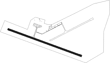
Proserpine - Proserpine Whitsunday Coast
Airport details
| Country | Australia |
| State | Queensland |
| Region | YB |
| Airspace | Brisbane Ctr |
| Municipality | Whitsunday Regional |
| Elevation | 82ft (25m) |
| Timezone | GMT +10 |
| Coordinates | -20.48977, 148.55888 |
| Magnetic var | |
| Type | land |
| Available since | X-Plane v10.40 |
| ICAO code | YBPN |
| IATA code | PPP |
| FAA code | n/a |
Communication
| Proserpine Whitsunday Coast CTAF | 126.700 |
Nearby Points of Interest:
St Paul's Anglican Church, Proserpine
-Proserpine Hospital
-Dent Island Light
-Bowen Harbour Board Building
-Bowen Courthouse
-Bowen Post Office
-Flemington Road Cemetery
Nearby beacons
| code | identifier | dist | bearing | frequency |
|---|---|---|---|---|
| PN | PROSERPINE VOR/DME | 0.5 | 221° | 113.70 |
| HM | HAMILTON I VOR/DME | 23.8 | 71° | 114.40 |
| MK | MACKAY NDB | 53.5 | 137° | 308 |
| MK | MACKAY VOR/DME | 54.1 | 137° | 112.70 |
Instrument approach procedures
| runway | airway (heading) | route (dist, bearing) |
|---|---|---|
| RW11-Z | PPPWD (104°) | PPPWD 5100ft PPPWI (5mi, 58°) 3620ft |
| RW11-Z | PPPWE (122°) | PPPWE 5100ft PPPWI (5mi, 125°) 3620ft |
| RW11-Z | PPPWG (141°) | PPPWG 5100ft PPPWI (5mi, 197°) 3620ft |
| RNAV | PPPWI 3620ft PPPWF (5mi, 125°) 2020ft PPPWM (5mi, 125°) 426ft PPPWH (4mi, 125°) (8592mi, 278°) 1900ft (turn) 5100ft | |
| RW29-Z | PPPEA (275°) | PPPEA 5100ft PPPEI (5mi, 226°) 3450ft |
| RW29-Z | PPPEB (294°) | PPPEB 5100ft PPPEI (5mi, 293°) 3450ft |
| RW29-Z | PPPEC (315°) | PPPEC 5100ft PPPEI (5mi, 5°) 3450ft |
| RNAV | PPPEI 3450ft PPPEF (5mi, 293°) 1860ft YBPN (6mi, 297°) 97ft PPPEH (2mi, 283°) (8590mi, 278°) 5100ft |
Disclaimer
The information on this website is not for real aviation. Use this data with the X-Plane flight simulator only! Data taken with kind consent from X-Plane 12 source code and data files. Content is subject to change without notice.
