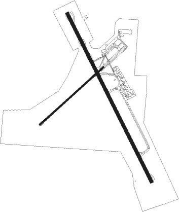
Rockhampton
Airport details
| Country | Australia |
| State | Queensland |
| Region | YB |
| Airspace | Brisbane Ctr |
| Municipality | Rockhampton |
| Elevation | 33ft (10m) |
| Timezone | GMT +10 |
| Coordinates | -23.37377, 150.47906 |
| Magnetic var | |
| Type | land |
| Available since | X-Plane v10.40 |
| ICAO code | YBRK |
| IATA code | ROK |
| FAA code | n/a |
Communication
| Rockhampton Rocky ATIS | 128.500 |
| Rockhampton Rocky Ground Control | 121.800 |
| Rockhampton Rocky Tower | 118.100 |
| Rockhampton Rocky Approach | 123.750 |
Nearby Points of Interest:
St Aubins, Rockhampton
-History of Rockhampton Base Hospital
-Alexandra Railway Bridge
-Rockhampton Courthouse
-Bulletin Building, Rockhampton
-St Paul's Cathedral, Rockhampton
-C J Edwards Chambers
-Australian Estates Building
-St Andrew's Presbyterian Church, Rockhampton
-AMP Building, Rockhampton
-Rockhampton Railway Workshops
-Glenmore Homestead
-Joskeleigh Cemetery
-Mount Morgan Mine
-St Mary's Anglican Church, Mount Morgan
-Coronation Lamp War Memorial
-Mount Morgan Cemetery
-Yeppoon State School building
-Yeppoon War Memorial
-Sea Hill Light
Nearby beacons
| code | identifier | dist | bearing | frequency |
|---|---|---|---|---|
| RK | ROCKHAMPTON NDB | 0.2 | 307° | 257 |
| RK | ROCKHAMPTON VOR/DME | 0.6 | 220° | 116.90 |
| GLA | GLADSTONE VOR | 49.6 | 124° | 116.30 |
Departure and arrival routes
| Transition altitude | 10000ft |
| Transition level | 11000ft |
| SID end points | distance | outbound heading | |
|---|---|---|---|
| RW15 | |||
| BUDGI2 | 24mi | 176° | |
| TARES2 | 50mi | 324° | |
| RW33 | |||
| BUDGI2 | 24mi | 176° | |
| TARES2 | 50mi | 324° | |
| STAR starting points | distance | inbound heading | |
|---|---|---|---|
| RW15 | |||
| ABVAS1 | 35.9 | 134° | |
| DADBO1 | 36.2 | 323° | |
| RW33 | |||
| ABVAS1 | 35.9 | 134° | |
| DADBO1 | 36.2 | 323° | |
Instrument approach procedures
| runway | airway (heading) | route (dist, bearing) |
|---|---|---|
| RW15-Z | BASOB (134°) | BASOB 3500ft BRKNI (5mi, 88°) 3440ft |
| RW15-Z | BRKNC (155°) | BRKNC 3500ft BRKNI (5mi, 156°) 3440ft |
| RW15-Z | GOKUN (176°) | GOKUN 3500ft BRKNI (5mi, 230°) 3440ft |
| RNAV | BRKNI 3440ft BRKNF (5mi, 156°) 1850ft BRKNM (5mi, 156°) 261ft BRKNH (3mi, 156°) (8588mi, 279°) 3500ft | |
| RW33-Z | BRKSJ (359°) | BRKSJ 3500ft BRKSI (5mi, 50°) 3350ft |
| RW33-Z | LALIS (317°) | LALIS 3500ft BRKSI (5mi, 268°) 3350ft |
| RW33-Z | SARUS (337°) | SARUS 3500ft BRKSI (5mi, 336°) 3350ft |
| RNAV | BRKSI 3350ft BRKSF (5mi, 336°) 1760ft YBRK (6mi, 339°) 78ft BRKSH (4mi, 331°) (8589mi, 279°) 3500ft |
Disclaimer
The information on this website is not for real aviation. Use this data with the X-Plane flight simulator only! Data taken with kind consent from X-Plane 12 source code and data files. Content is subject to change without notice.

