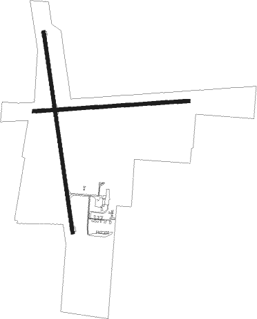
Bathurst
Airport details
| Country | Australia |
| State | New South Wales |
| Region | YM |
| Airspace | Melbourne Ctr |
| Municipality | Bathurst |
| Elevation | 2435ft (742m) |
| Timezone | GMT +10 |
| Coordinates | -33.41360, 149.65584 |
| Magnetic var | |
| Type | land |
| Available since | X-Plane v10.40 |
| ICAO code | YBTH |
| IATA code | BHS |
| FAA code | n/a |
Communication
| Bathurst BATHURST AWIS | 133.250 |
| Bathurst BATHURST AFRU+PAL | 127.350 |
| Bathurst MELBOURNE CENTRE | 135.250 |
| Bathurst BATHURST CTAF+AFRU | 127.350 |
Nearby Points of Interest:
Denison Bridge
-Macquarie River railway bridge, Bathurst
-Old Government Cottages Group, Bathurst
-Bentinck Street houses, Bathurst
-Howick Street houses
-Bathurst railway station
-Bathurst Street Lamps
-Royal Hotel, Bathurst
-Bathurst Courthouse
-Bathurst Old School of Arts Library Collection
-Ben Chifley's House
-Miss Traill's House
-Abercrombie House
-Old Bathurst Hospital
-Bathurst Correctional Complex
-The Grange and Macquarie Plains Cemetery
-Llanarth (house)
-Wambool old-rail truss overbridges
-Georges Plains railway station
-Tarana railway station
-Raglan railway station, New South Wales
-Rydal railway station
-Rydal rail underbridges
-Oberon railway station
-Malachi Gilmore Memorial Hall
Nearby beacons
| code | identifier | dist | bearing | frequency |
|---|---|---|---|---|
| BTH | BATHURST NDB | 0 | 111° | 383 |
| MDG | MUDGEE NDB | 50.9 | 357° | 398 |
Instrument approach procedures
| runway | airway (heading) | route (dist, bearing) |
|---|---|---|
| RW17 | BTHNA (151°) | BTHNA 5200ft BTHNI (5mi, 104°) 5200ft |
| RW17 | BTHNC (198°) | BTHNC 5700ft BTHNI (5mi, 250°) 5200ft |
| RW17 | BTHND (175°) | BTHND 5200ft BTHNI (5mi, 175°) 5200ft |
| RNAV | BTHNI 5200ft BTHNF (5mi, 175°) 4120ft YBTH (6mi, 173°) 2441ft BTHNH (2mi, 183°) (8171mi, 283°) 5200ft | |
| RW35 | BTHSE (331°) | BTHSE 5700ft BTHSI (5mi, 284°) 5200ft |
| RW35 | BTHSG (356°) | BTHSG 5700ft BTHSI (5mi, 355°) 5200ft |
| RW35 | BTHSJ (22°) | BTHSJ 5200ft BTHSI (5mi, 70°) 5200ft |
| RNAV | BTHSI 5200ft BTHSF (5mi, 355°) 4080ft YBTH (5mi, 358°) 2484ft BTHSH (3mi, 351°) (8175mi, 283°) 5700ft |
Disclaimer
The information on this website is not for real aviation. Use this data with the X-Plane flight simulator only! Data taken with kind consent from X-Plane 12 source code and data files. Content is subject to change without notice.

