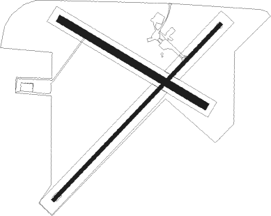
Bowen
Airport details
| Country | Australia |
| State | Queensland |
| Region | YB |
| Airspace | Brisbane Ctr |
| Municipality | Bowen |
| Elevation | 21ft (6m) |
| Timezone | GMT +10 |
| Coordinates | -20.01778, 148.21527 |
| Magnetic var | |
| Type | land |
| Available since | X-Plane v10.32 |
| ICAO code | YBWN |
| IATA code | ZBO |
| FAA code | n/a |
Communication
| Bowen ACTIVATE LIGHTS ONLY MULT | 120.250 |
| Bowen BOWEN MULT | 126.700 |
| Bowen BOWEN CTAF | 126.700 |
| Bowen BRISBANE CNTR | 135.500 |
Nearby Points of Interest:
Flemington Road Cemetery
-Bowen Post Office
-Bowen Courthouse
-Bowen Harbour Board Building
-St Paul's Anglican Church, Proserpine
-Proserpine Hospital
Nearby beacons
| code | identifier | dist | bearing | frequency |
|---|---|---|---|---|
| PN | PROSERPINE VOR/DME | 34.4 | 145° | 113.70 |
| HM | HAMILTON I VOR/DME | 46.3 | 114° | 114.40 |
Instrument approach procedures
| runway | airway (heading) | route (dist, bearing) |
|---|---|---|
| RWNVN | ZBOND (213°) | ZBOND 3300ft ZBONI (5mi, 162°) 3250ft |
| RWNVN | ZBONE (235°) | ZBONE 3300ft ZBONI (5mi, 235°) 3250ft |
| RWNVN | ZBONG (255°) | ZBONG 3300ft ZBONI (5mi, 302°) 3250ft |
| RNAV | ZBONI 3250ft ZBONF (5mi, 235°) 1660ft ZBONM (5mi, 235°) 65ft ZBONH (4mi, 235°) 1500ft (8585mi, 278°) 3300ft | |
| RWNVS | ZBOSA (28°) | ZBOSA 4700ft ZBOSI (5mi, 337°) 3260ft |
| RWNVS | ZBOSB (50°) | ZBOSB 4700ft ZBOSI (5mi, 50°) 3260ft |
| RWNVS | ZBOSC (70°) | ZBOSC 4700ft ZBOSI (5mi, 117°) 3260ft |
| RNAV | ZBOSI 3260ft ZBOSF (5mi, 50°) 1670ft ZBOSM (5mi, 50°) 76ft ZBOSH (4mi, 50°) (8592mi, 278°) 3300ft |
Disclaimer
The information on this website is not for real aviation. Use this data with the X-Plane flight simulator only! Data taken with kind consent from X-Plane 12 source code and data files. Content is subject to change without notice.

