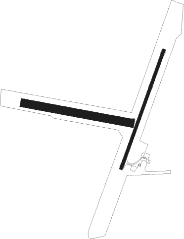
Condobolin
Airport details
| Country | Australia |
| State | New South Wales |
| Region | YM |
| Airspace | Melbourne Ctr |
| Municipality | Condobolin |
| Elevation | 645ft (197m) |
| Timezone | GMT +11 |
| Coordinates | -33.06445, 147.20917 |
| Magnetic var | |
| Type | land |
| Available since | X-Plane v10.40 |
| ICAO code | YCDO |
| IATA code | CBX |
| FAA code | n/a |
Communication
| Condobolin CTAF | 126.700 |
Nearby Points of Interest:
All Saints' Anglican Church, Condobolin

Instrument approach procedures
| runway | airway (heading) | route (dist, bearing) |
|---|---|---|
| RW01 | CDOSA (4°) | CDOSA 2800ft CDOSI (5mi, 310°) 2800ft |
| RW01 | CDOSB (28°) | CDOSB 2800ft CDOSI (5mi, 29°) 2800ft |
| RW01 | CDOSC (49°) | CDOSC 2800ft CDOSI (5mi, 94°) 2800ft |
| RNAV | CDOSI 2800ft CDOSF (5mi, 29°) 2450ft CDOSM (5mi, 29°) 860ft CDOSH (3mi, 28°) (8097mi, 283°) 2800ft | |
| RWNVN | CDOND (185°) | CDOND 2800ft CDONI (5mi, 130°) 2800ft |
| RWNVN | CDONE (209°) | CDONE 2800ft CDONI (5mi, 208°) 2800ft |
| RWNVN | CDONG (231°) | CDONG 2800ft CDONI (5mi, 274°) 2800ft |
| RNAV | CDONI 2800ft CDONF (5mi, 208°) 2290ft CDONM (5mi, 208°) 704ft CDONH (4mi, 209°) (8092mi, 283°) 2800ft |
Disclaimer
The information on this website is not for real aviation. Use this data with the X-Plane flight simulator only! Data taken with kind consent from X-Plane 12 source code and data files. Content is subject to change without notice.