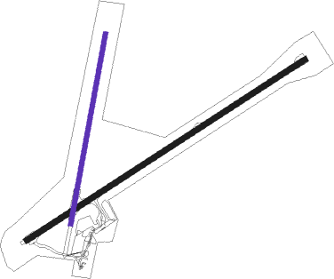
Charters Towers
Airport details
| Country | Australia |
| State | Queensland |
| Region | YB |
| Airspace | Brisbane Ctr |
| Municipality | Charters Towers Regional |
| Elevation | 955ft (291m) |
| Timezone | GMT +10 |
| Coordinates | -20.04333, 146.27333 |
| Magnetic var | |
| Type | land |
| Available since | X-Plane v10.40 |
| ICAO code | YCHT |
| IATA code | CXT |
| FAA code | n/a |
Communication
| Charters Towers CTAF | 126.700 |
Nearby Points of Interest:
Bore Sight Range and Compass Swinging Platform at Charters Towers Airfield
-Boer War Veterans Memorial Kiosk and Lissner Park
-Signals, Crane and Subway, Charters Towers Railway Station
-Ambulance Building, Charters Towers
-Charters Towers Police Station
-St Columba's Church Bell Tower
-Charters Towers Stock Exchange Arcade
-Charters Towers Courthouse
-Breddan Aerodrome
-Burdekin River Rail Bridge
-Ravenswood Mining Landscape and Chinese Settlement Area
-Mabel Mill
-London North Mine
-Ravenswood Ambulance Station
Nearby beacons
| code | identifier | dist | bearing | frequency |
|---|---|---|---|---|
| TVL | TOWNSVILLE TACAN | 53 | 32° | 113.50 |
| TL | TOWNSVILLE VOR/DME | 55.2 | 31° | 114.10 |
| TVL | TOWNSVILLE NDB | 55.2 | 32° | 276 |
Disclaimer
The information on this website is not for real aviation. Use this data with the X-Plane flight simulator only! Data taken with kind consent from X-Plane 12 source code and data files. Content is subject to change without notice.

