Cooranga
Airport details
| Country | Australia |
| State | South Australia |
| Region | YM |
| Airspace | Melbourne Ctr |
| Municipality | Naracoorte Lucindale Council |
| Elevation | 77ft (23m) |
| Timezone | GMT +10.5 |
| Coordinates | -36.81513, 140.27003 |
| Magnetic var | |
| Type | land |
| Available since | X-Plane v10.40 |
| ICAO code | YCNG |
| IATA code | n/a |
| FAA code | n/a |
Communication
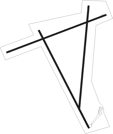
Runway info
Runway 15 / 33  | ||
| length | 1034m (3392ft) | |
| bearing | 152° / 332° | |
| width | 15m (49ft) | |
| surface | dirt | |
| Runway 07 / 25 | ||
| length | 1003m (3291ft) | |
| bearing | 77° / 257° | |
| width | 15m (49ft) | |
| surface | dirt | |
| Runway 01 / 19 | ||
| length | 978m (3209ft) | |
| bearing | 12° / 192° | |
| width | 15m (49ft) | |
| surface | dirt | |
Nearby beacons
| code | identifier | dist | bearing | frequency |
|---|---|---|---|---|
| BOR | BORDERTOWN NDB | 34.4 | 49° | 251 |
| MTG | MOUNT GAMBIER NDB | 61.3 | 151° | 266 |
Disclaimer
The information on this website is not for real aviation. Use this data with the X-Plane flight simulator only! Data taken with kind consent from X-Plane 12 source code and data files. Content is subject to change without notice.