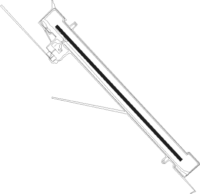
Century Mine
Airport details
| Country | Australia |
| State | Queensland |
| Region | YB |
| Airspace | Brisbane Ctr |
| Municipality | Burke Shire |
| Elevation | 416ft (127m) |
| Timezone | GMT +10 |
| Coordinates | -18.75333, 138.70667 |
| Magnetic var | |
| Type | land |
| Available since | X-Plane v10.40 |
| ICAO code | YCNY |
| IATA code | n/a |
| FAA code | n/a |
Communication
| Century Mine CTAF | 126.700 |
Nearby Points of Interest:
Riversleigh
-Australian Fossil Mammal Sites (Riversleigh / Naracoorte)
Instrument approach procedures
| runway | airway (heading) | route (dist, bearing) |
|---|---|---|
| RW14-Z | CNYNA (119°) | CNYNA 3500ft CNYNI (5mi, 72°) 3500ft |
| RW14-Z | CNYNC (140°) | CNYNC 3500ft CNYNI (5mi, 140°) 3500ft |
| RW14-Z | CNYND (162°) | CNYND 3500ft CNYNI (5mi, 213°) 3500ft |
| RNAV | CNYNI 3500ft CNYNF (5mi, 140°) 2140ft YCNY (5mi, 139°) 461ft CNYNH (5mi, 141°) (8130mi, 278°) 2400ft | |
| RW32-Z | CNYSE (300°) | CNYSE 3500ft CNYSI (5mi, 252°) 3500ft |
| RW32-Z | CNYSG (320°) | CNYSG 3500ft CNYSI (5mi, 320°) 3500ft |
| RW32-Z | CNYSJ (341°) | CNYSJ 3500ft CNYSI (5mi, 33°) 3500ft |
| RNAV | CNYSI 3500ft CNYSF (5mi, 320°) 2140ft YCNY (6mi, 321°) 466ft CNYSH (4mi, 319°) (8128mi, 278°) 2400ft |
Disclaimer
The information on this website is not for real aviation. Use this data with the X-Plane flight simulator only! Data taken with kind consent from X-Plane 12 source code and data files. Content is subject to change without notice.
