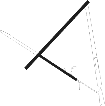
West Swan - Caversham (raaf Disused)
Airport details
| Country | Australia |
| State | Western Australia |
| Region | |
| Airspace | Melbourne Ctr |
| Municipality | City Of Swan |
| Elevation | 85ft (26m) |
| Timezone | GMT +8 |
| Coordinates | -31.83945, 115.96936 |
| Magnetic var | |
| Type | land |
| Available since | X-Plane v10.40 |
| ICAO code | YCVM |
| IATA code | n/a |
| FAA code | n/a |
Communication
Nearby Points of Interest:
Guildford Grammar School Chapel
-St Matthew's Church, Guildford
-Garrick Theatre
-Bassendean Fire Station
-Garratt Road Bridge
-Inglewood Post Office
-Statham's Quarry
-Albany Bell Castle
-Maylands Airport
-East Perth Power Station
-Bunbury Railway Bridge
-Burswood canal
-Dilhorn House
-Gloucester Park
-Anzac Cottage
-Swan Barracks
-Perth Trades Hall
-Hackett Hall
-Rechabite Hall
-Royal Perth Hospital
-Art Gallery of Western Australia
-ChemCentre
-The Causeway
-Horseshoe Bridge
-Phineas Seeligson's
Nearby beacons
| code | identifier | dist | bearing | frequency |
|---|---|---|---|---|
| PH | PERTH VOR/DME | 6.3 | 186° | 113.70 |
| PEA | PEARCE TACAN | 10.2 | 16° | 112.80 |
| PEA | PEARCE NDB | 11.3 | 15° | 340 |
| JT | JANDAKOT NDB | 16.3 | 197° | 281 |
| GIG | GINGIN NDB | 23.4 | 345° | 372 |
Disclaimer
The information on this website is not for real aviation. Use this data with the X-Plane flight simulator only! Data taken with kind consent from X-Plane 12 source code and data files. Content is subject to change without notice.

