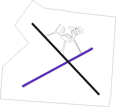
Deniliquin
Airport details
| Country | Australia |
| State | New South Wales |
| Region | YM |
| Airspace | Melbourne Ctr |
| Municipality | Deniliquin |
| Elevation | 314ft (96m) |
| Timezone | GMT +11 |
| Coordinates | -35.55944, 144.94640 |
| Magnetic var | |
| Type | land |
| Available since | X-Plane v10.40 |
| ICAO code | YDLQ |
| IATA code | DNQ |
| FAA code | n/a |
Communication
| Deniliquin AWIS | 133.200 |
| Deniliquin CTAF | 119.000 |
Nearby Points of Interest:
St Andrew's Uniting Church, Deniliquin
-Old St Paul's Anglican Church, Deniliquin
-Deniliquin Public School and School Master's Residence
-Finley Pioneer Railway Station
Nearby beacons
| code | identifier | dist | bearing | frequency |
|---|---|---|---|---|
| SHT | SHEPPARTON NDB | 56.5 | 153° | 212 |
Instrument approach procedures
| runway | airway (heading) | route (dist, bearing) |
|---|---|---|
| RW06-Z | DLQWD (51°) | DLQWD 2100ft DLQWI (5mi, 355°) 2100ft |
| RW06-Z | DLQWE (70°) | DLQWE 2100ft DLQWI (5mi, 70°) 2100ft |
| RW06-Z | DLQWG (88°) | DLQWG 2100ft DLQWI (5mi, 130°) 2100ft |
| RNAV | DLQWI 2100ft DLQWF (5mi, 70°) 2040ft DLQWM (5mi, 70°) 450ft DLQWH (3mi, 70°) (7915mi, 284°) 1900ft | |
| RW24-Z | DLQEA (231°) | DLQEA 2100ft DLQEI (5mi, 175°) 2100ft |
| RW24-Z | DLQEB (250°) | DLQEB 2100ft DLQEI (5mi, 250°) 2100ft |
| RW24-Z | DLQEC (267°) | DLQEC 2100ft DLQEI (5mi, 310°) 2100ft |
| RNAV | DLQEI 2100ft DLQEF (5mi, 250°) 2040ft DLQEM (5mi, 250°) 445ft DLQEH (3mi, 250°) (7911mi, 284°) 1900ft |
Disclaimer
The information on this website is not for real aviation. Use this data with the X-Plane flight simulator only! Data taken with kind consent from X-Plane 12 source code and data files. Content is subject to change without notice.

