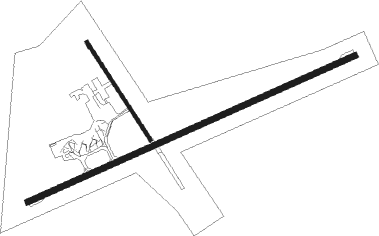
Emerald
Airport details
| Country | Australia |
| State | Queensland |
| Region | YB |
| Airspace | Brisbane Ctr |
| Municipality | Central Highlands Regional |
| Elevation | 623ft (190m) |
| Timezone | GMT +10 |
| Coordinates | -23.57006, 148.17281 |
| Magnetic var | |
| Type | land |
| Available since | X-Plane v10.40 |
| ICAO code | YEML |
| IATA code | EMD |
| FAA code | n/a |
Communication
| Emerald AWIS | 132.950 |
| Emerald CTAF | 126.700 |
Nearby Points of Interest:
Emerald railway station, Queensland
-Springsure Hospital Museum
-Tieri War Memorial
Nearby beacons
| code | identifier | dist | bearing | frequency |
|---|---|---|---|---|
| EML | EMERALD NDB | 0.1 | 326° | 324 |
| DYS | DYSART NDB | 59.2 | 10° | 227 |
Instrument approach procedures
| runway | airway (heading) | route (dist, bearing) |
|---|---|---|
| RW06-Z | EMLWA (51°) | EMLWA 3300ft EMLWI (5mi, 1°) 3300ft |
| RW06-Z | EMLWB (72°) | EMLWB 3300ft EMLWI (5mi, 72°) 3300ft |
| RW06-Z | EMLWC (91°) | EMLWC 3300ft EMLWI (5mi, 138°) 3300ft |
| RNAV | EMLWI 3300ft EMLWF (5mi, 72°) 2350ft YEML (5mi, 71°) 670ft EMLWH (3mi, 74°) (8479mi, 279°) 3300ft | |
| RW24-Z | EMLED (233°) | EMLED 3300ft EMLEI (5mi, 181°) 3300ft |
| RW24-Z | EMLEE (252°) | EMLEE 3300ft EMLEI (5mi, 252°) 3300ft |
| RW24-Z | EMLEG (271°) | EMLEG 3300ft EMLEI (5mi, 318°) 3300ft |
| RNAV | EMLEI 3300ft EMLEF (5mi, 252°) 2330ft YEML (6mi, 253°) 655ft EMLEH (2mi, 249°) (8475mi, 279°) 3300ft |
Disclaimer
The information on this website is not for real aviation. Use this data with the X-Plane flight simulator only! Data taken with kind consent from X-Plane 12 source code and data files. Content is subject to change without notice.

