Flinders Island - Flinders Island (tas)
Airport details
| Country | Australia |
| State | Tasmania |
| Region | YM |
| Airspace | Melbourne Ctr |
| Municipality | Whitemark |
| Elevation | 33ft (10m) |
| Timezone | GMT +10 |
| Coordinates | -40.09139, 147.99278 |
| Magnetic var | |
| Type | land |
| Available since | X-Plane v10.40 |
| ICAO code | YFLI |
| IATA code | FLS |
| FAA code | n/a |
Communication
| Flinders Island (TAS) ACTIVATE LIGHTS ONLY MULT | 119.600 |
| Flinders Island (TAS) FLINDERS IS MULT | 124.200 |
| Flinders Island (TAS) MELBOURNE CNTR | 126.500 |
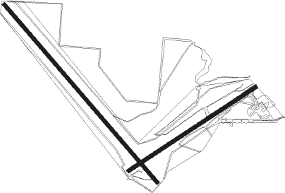
Runway info
Runway 05 / 23  | ||
| length | 1191m (3907ft) | |
| bearing | 67° / 247° | |
| width | 31m (102ft) | |
| surface | asphalt | |
| displ threshold | 58m (190ft) / 115m (377ft) | |
| Runway 14 / 32 | ||
| length | 1839m (6033ft) | |
| bearing | 136° / 316° | |
| width | 31m (102ft) | |
| surface | asphalt | |
| displ threshold | 71m (233ft) / 47m (154ft) | |
Instrument approach procedures
| runway | airway (heading) | route (dist, bearing) |
|---|---|---|
| RW05-Y | FLIWA (46°) | FLIWA 3800ft FLIWI (5mi, 349°) 3250ft |
| RW05-Y | FLIWB (67°) | FLIWB 3800ft FLIWI (5mi, 67°) 3250ft |
| RW05-Y | FLIWC (84°) | FLIWC 3800ft FLIWI (5mi, 124°) 3250ft |
| RNAV | FLIWI 3250ft FLIWF (5mi, 67°) 1660ft YFLI (5mi, 66°) 67ft FLIWH (5mi, 195°) (7830mi, 285°) 3800ft | |
| RW05-Z | FLIZA (53°) | FLIZA 3800ft FLIZI (5mi, 355°) 3600ft |
| RW05-Z | FLIZB (71°) | FLIZB 3800ft FLIZI (5mi, 72°) 3600ft |
| RW05-Z | FLIZC (87°) | FLIZC 3800ft FLIZI (5mi, 129°) 3600ft |
| RNAV | FLIZI 3600ft FLIZF (5mi, 72°) 2010ft FLIZM (5mi, 71°) 418ft FLIZH (4mi, 206°) (7829mi, 285°) 3800ft |
Disclaimer
The information on this website is not for real aviation. Use this data with the X-Plane flight simulator only! Data taken with kind consent from X-Plane 12 source code and data files. Content is subject to change without notice.