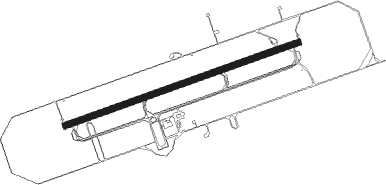
Gingin
Airport details
| Country | Australia |
| State | Western Australia |
| Region | YM |
| Airspace | Melbourne Ctr |
| Municipality | Shire Of Gingin |
| Elevation | 249ft (76m) |
| Timezone | GMT +8 |
| Coordinates | -31.46528, 115.86333 |
| Magnetic var | |
| Type | land |
| Available since | X-Plane v10.40 |
| ICAO code | YGIG |
| IATA code | n/a |
| FAA code | n/a |
Communication
| Gingin GINGIN CTAF | 118.500 |
| Gingin GINGIN Ground Control | 121.650 |
| Gingin GINGIN Tower | 118.500 |
| Gingin PEARCE Approach | 123.300 |
| Gingin PERTH Approach | 128.100 |
| Gingin PEARCE Departure | 135.900 |
Nearby Points of Interest:
Guildford Grammar School Chapel
-St Matthew's Church, Guildford
-Garrick Theatre
-Bassendean Fire Station
-Inglewood Post Office
-Anzac Cottage
-Garratt Road Bridge
-Albany Bell Castle
-Paganin House
-Model Timber Home
-Model Brick Home
-Dilhorn House
-Subiaco Oval
-East Perth Power Station
-Bunbury Railway Bridge
-Rechabite Hall
-Swan Barracks
-Hackett Hall
-Perth Trades Hall
-Horseshoe Bridge
-Art Gallery of Western Australia
-King Edward Memorial Hospital for Women
-Maylands Airport
-Royal Hotel
-Raine Square
Nearby beacons
| code | identifier | dist | bearing | frequency |
|---|---|---|---|---|
| GIG | GINGIN NDB | 0.3 | 22° | 372 |
| PEA | PEARCE NDB | 13.8 | 141° | 340 |
| PEA | PEARCE TACAN | 14.8 | 144° | 112.80 |
| PH | PERTH VOR/DME | 29.2 | 169° | 113.70 |
| JT | JANDAKOT NDB | 38.3 | 178° | 281 |
Instrument approach procedures
| runway | airway (heading) | route (dist, bearing) |
|---|---|---|
| RW08 | GIGWD (94°) | GIGWD 2800ft GIGWI (4mi, 141°) 2800ft |
| RW08 | GIGWE (77°) | GIGWE 2800ft GIGWI (4mi, 77°) 2800ft |
| RW08 | GIGWG (60°) | GIGWG 2800ft GIGWI (4mi, 6°) 2800ft |
| RNAV | GIGWI 2800ft GIGWF (5mi, 77°) 1550ft GIGWM (4mi, 77°) 276ft (6717mi, 285°) 3000ft | |
| RW26 | GIGEA (240°) | GIGEA 2800ft GIGEI (4mi, 185°) 2800ft |
| RW26 | GIGEB (257°) | GIGEB 2800ft GIGEI (4mi, 257°) 2800ft |
| RW26 | GIGEC (273°) | GIGEC 2800ft GIGEI (4mi, 320°) 2800ft |
| RNAV | GIGEI 2800ft GIGEF (5mi, 257°) 1550ft GIGEM (4mi, 257°) 273ft (6718mi, 285°) 3000ft |
Disclaimer
The information on this website is not for real aviation. Use this data with the X-Plane flight simulator only! Data taken with kind consent from X-Plane 12 source code and data files. Content is subject to change without notice.
