Glencoe
Airport details
| Country | Australia |
| State | New South Wales |
| Region | YB |
| Airspace | Melbourne Ctr |
| Municipality | Warren Shire Council |
| Elevation | 732ft (223m) |
| Timezone | GMT +11 |
| Coordinates | -31.62079, 148.19424 |
| Magnetic var | |
| Type | land |
| Available since | X-Plane v10.40 |
| ICAO code | YGLC |
| IATA code | n/a |
| FAA code | n/a |
Communication
Nearby Points of Interest:
St Ambrose Church, Gilgandra
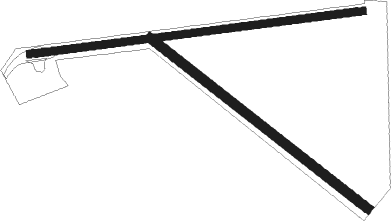
Runway info
Runway 8 / 26  | ||
| length | 1048m (3438ft) | |
| bearing | 87° / 267° | |
| width | 23m (75ft) | |
| surface | dirt | |
| Runway 13 / 31 | ||
| length | 860m (2822ft) | |
| bearing | 128° / 308° | |
| width | 30m (98ft) | |
| surface | grass | |
Nearby beacons
| code | identifier | dist | bearing | frequency |
|---|---|---|---|---|
| DU | DUBBO NDB | 40.3 | 149° | 251 |
Disclaimer
The information on this website is not for real aviation. Use this data with the X-Plane flight simulator only! Data taken with kind consent from X-Plane 12 source code and data files. Content is subject to change without notice.