Shelburne - Hicks Island
Airport details
| Country | Australia |
| State | Queensland |
| Region | YB |
| Airspace | Brisbane Ctr |
| Municipality | Cook Shire |
| Elevation | 48ft (15m) |
| Timezone | GMT +10 |
| Coordinates | -11.98155, 143.26498 |
| Magnetic var | |
| Type | land |
| Available since | X-Plane v10.40 |
| ICAO code | YHKI |
| IATA code | n/a |
| FAA code | n/a |
Communication
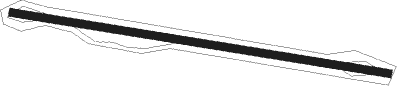
Runway info
| Runway 10 / 28 | ||
| length | 731m (2398ft) | |
| bearing | 103° / 283° | |
| width | 15m (49ft) | |
| surface | dirt | |
Nearby beacons
| code | identifier | dist | bearing | frequency |
|---|---|---|---|---|
| LHR | LOCKHART RIVER NDB | 48.5 | 177° | 392 |
Disclaimer
The information on this website is not for real aviation. Use this data with the X-Plane flight simulator only! Data taken with kind consent from X-Plane 12 source code and data files. Content is subject to change without notice.