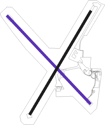
Innisfail
Airport details
| Country | Australia |
| State | Queensland |
| Region | YB |
| Airspace | Brisbane Ctr |
| Municipality | Cassowary Coast Regional |
| Elevation | 44ft (13m) |
| Timezone | GMT +10 |
| Coordinates | -17.56045, 146.01486 |
| Magnetic var | |
| Type | land |
| Available since | X-Plane v10.40 |
| ICAO code | YIFL |
| IATA code | IFL |
| FAA code | n/a |
Communication
| Innisfail CTAF | 132.900 |
Nearby Points of Interest:
Innisfail Courthouse
-St Saviour's Anglican Church, South Johnstone
-St Andrew's Presbyterian Memorial Church, Innisfail
-Paronella Park
-Garners Beach Burial Ground
-Wet Tropics of Queensland
-Banfield Memorial Reserve and Grave
-St James Catholic Church, Malanda
-Alley Family Graves
-Bank of New South Wales Building, Yungaburra
-Eden House Restaurant
-Billy Madrid's House
-7-9 Cedar Street, Yungaburra
-Yungaburra Community Centre
-Yungaburra Post Office
-Evelyn Scrub War Memorial
-Cressbrook Cemetery
-Great Northern Mine
-Herberton War Memorial
Nearby beacons
| code | identifier | dist | bearing | frequency |
|---|---|---|---|---|
| IFL | INNISFAIL NDB | 0 | 156° | 212 |
| CS | CAIRNS VOR/DME | 45.4 | 339° | 113 |
| CS | CAIRNS NDB | 45.7 | 339° | 364 |
Instrument approach procedures
| runway | airway (heading) | route (dist, bearing) |
|---|---|---|
| RW32 | IFLEA (301°) | IFLEA 5000ft IFLEI (5mi, 252°) 3720ft |
| RW32 | IFLEB (320°) | IFLEB 5000ft IFLEI (5mi, 320°) 3720ft |
| RW32 | IFLEC (340°) | IFLEC 5000ft IFLEI (5mi, 32°) 3720ft |
| RNAV | IFLEI 3720ft IFLEF (5mi, 320°) 2130ft IFLEM (5mi, 320°) 535ft (8543mi, 277°) 1700ft IFLEH (8548mi, 97°) 4500ft (8548mi, 277°) 5000ft |
Disclaimer
The information on this website is not for real aviation. Use this data with the X-Plane flight simulator only! Data taken with kind consent from X-Plane 12 source code and data files. Content is subject to change without notice.

