Ingham
Airport details
| Country | Australia |
| State | Queensland |
| Region | YB |
| Airspace | Brisbane Ctr |
| Municipality | Hinchinbrook Shire |
| Elevation | 47ft (14m) |
| Timezone | GMT +10 |
| Coordinates | -18.66055, 146.15167 |
| Magnetic var | |
| Type | land |
| Available since | X-Plane v10.40 |
| ICAO code | YIGM |
| IATA code | IGH |
| FAA code | n/a |
Communication
| Ingham CTAF | 126.700 |
Nearby Points of Interest:
Gairloch Bridge
-Stone Bridge, Dalrymple Gap Track
-Fantome Island Lock Hospital and Lazaret Sites
-Little Crystal Creek Bridge
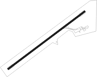
Runway info
| Runway 05 / 23 | ||
| length | 1532m (5026ft) | |
| bearing | 59° / 239° | |
| width | 30m (98ft) | |
| surface | asphalt | |
Nearby beacons
| code | identifier | dist | bearing | frequency |
|---|---|---|---|---|
| TL | TOWNSVILLE VOR/DME | 49.1 | 134° | 114.10 |
| TVL | TOWNSVILLE NDB | 49.4 | 134° | 276 |
| TVL | TOWNSVILLE TACAN | 50 | 136° | 113.50 |
Disclaimer
The information on this website is not for real aviation. Use this data with the X-Plane flight simulator only! Data taken with kind consent from X-Plane 12 source code and data files. Content is subject to change without notice.