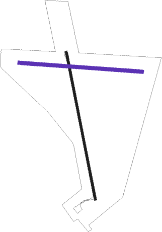
Ivanhoe
Airport details
| Country | Australia |
| State | New South Wales |
| Region | YM |
| Airspace | Melbourne Ctr |
| Municipality | Ivanhoe |
| Elevation | 330ft (101m) |
| Timezone | GMT +10 |
| Coordinates | -32.88334, 144.31000 |
| Magnetic var | |
| Type | land |
| Available since | X-Plane v10.40 |
| ICAO code | YIVO |
| IATA code | n/a |
| FAA code | n/a |
Communication
| Ivanhoe Ivanhoe AWIS | 133.700 |
| Ivanhoe Ivanhoe CTAF | 126.700 |
Departure and arrival routes
| Transition altitude | 10000ft |
| Transition level | 11000ft |
| SID end points | distance | outbound heading | |
|---|---|---|---|
| RW16 | |||
| IVANH1 | 51mi | 21° | |
| RW34 | |||
| IVANH1 | 51mi | 21° | |
Instrument approach procedures
| runway | airway (heading) | route (dist, bearing) |
|---|---|---|
| RW16 | IVZNA (148°) | IVZNA 2000ft IVZNI (5mi, 101°) 2000ft |
| RW16 | IVZNC (172°) | IVZNC 2000ft IVZNI (5mi, 172°) 2000ft |
| RW16 | IVZND (198°) | IVZND 2000ft IVZNI (5mi, 247°) 2000ft |
| RNAV | IVZNI 2000ft IVZNF (5mi, 172°) 1970ft IVZNM (5mi, 172°) 381ft IVZNH (3mi, 172°) (7986mi, 283°) 1900ft | |
| RW34 | IVZSE (328°) | IVZSE 2000ft IVZSI (5mi, 281°) 2000ft |
| RW34 | IVZSG (352°) | IVZSG 2000ft IVZSI (5mi, 352°) 2000ft |
| RW34 | IVZSJ (17°) | IVZSJ 2000ft IVZSI (5mi, 67°) 2000ft |
| RNAV | IVZSI 2000ft IVZSF (5mi, 352°) 1950ft IVZSM (5mi, 352°) 356ft IVZSH (3mi, 352°) (7989mi, 283°) 1900ft |
Disclaimer
The information on this website is not for real aviation. Use this data with the X-Plane flight simulator only! Data taken with kind consent from X-Plane 12 source code and data files. Content is subject to change without notice.

