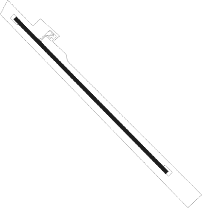
Yellabinna - Jacinth Ambrosia
Airport details
| Country | Australia |
| State | South Australia |
| Region | YM |
| Airspace | Melbourne Ctr |
| Municipality | Pastoral Unincorporated Area |
| Elevation | 418ft (127m) |
| Timezone | GMT +10.5 |
| Coordinates | -30.89651, 132.18048 |
| Magnetic var | |
| Type | land |
| Available since | X-Plane v10.40 |
| ICAO code | YJAC |
| IATA code | n/a |
| FAA code | n/a |
Communication
| Jacinth Ambrosia CTAF | 126.700 |
Runway info
| Runway 14 / 32 | ||
| length | 1801m (5909ft) | |
| bearing | 136° / 316° | |
| width | 30m (98ft) | |
| surface | asphalt | |
Departure and arrival routes
| Transition altitude | 10000ft |
| Transition level | 11000ft |
| SID end points | distance | outbound heading | |
|---|---|---|---|
| RW14 | |||
| JACIN1 | 57mi | 72° | |
| RW32 | |||
| JACIN1 | 57mi | 72° | |
Instrument approach procedures
| runway | airway (heading) | route (dist, bearing) |
|---|---|---|
| RWNVN | JZCND (115°) | JZCND 2100ft JZCNI (5mi, 72°) 2100ft |
| RWNVN | JZCNE (135°) | JZCNE 2100ft JZCNI (5mi, 136°) 2100ft |
| RWNVN | JZCNG (158°) | JZCNG 2100ft JZCNI (5mi, 214°) 2100ft |
| RNAV | JZCNI 2100ft JZCNF (5mi, 136°) 2000ft JZCNM (5mi, 136°) 409ft JZCNH (3mi, 135°) (7519mi, 283°) 2100ft | |
| RWNVS | JZCSA (296°) | JZCSA 2100ft JZCSI (5mi, 252°) 2100ft |
| RWNVS | JZCSB (316°) | JZCSB 2100ft JZCSI (5mi, 315°) 2100ft |
| RWNVS | JZCSC (338°) | JZCSC 2100ft JZCSI (5mi, 34°) 2100ft |
| RNAV | JZCSI 2100ft JZCSF (5mi, 315°) 2060ft JZCSM (5mi, 315°) 465ft JZCSH (3mi, 316°) (7518mi, 283°) 2100ft |
Disclaimer
The information on this website is not for real aviation. Use this data with the X-Plane flight simulator only! Data taken with kind consent from X-Plane 12 source code and data files. Content is subject to change without notice.
