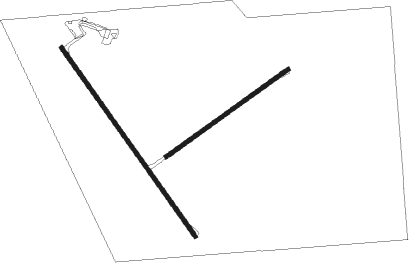
Kerang
Airport details
| Country | Australia |
| State | Victoria |
| Region | YM |
| Airspace | Melbourne Ctr |
| Municipality | Kerang |
| Elevation | 250ft (76m) |
| Timezone | GMT +11 |
| Coordinates | -35.75139, 143.93944 |
| Magnetic var | |
| Type | land |
| Available since | X-Plane v10.40 |
| ICAO code | YKER |
| IATA code | KRA |
| FAA code | n/a |
Communication
| Kerang CTAF | 126.700 |
Nearby Points of Interest:
Barham Bridge over Murray River
-Swan Hill-Murray River Road Bridge
Nearby beacons
| code | identifier | dist | bearing | frequency |
|---|---|---|---|---|
| SWH | SWAN HILL NDB | 29.6 | 313° | 407 |
Instrument approach procedures
| runway | airway (heading) | route (dist, bearing) |
|---|---|---|
| RW14 | KE2ND (122°) | KE2ND 2000ft KE2NI (4mi, 81°) 2000ft |
| RW14 | KE2NG (167°) | KE2NG 2000ft KE2NI (4mi, 225°) 2000ft |
| RW14 | KE2NK (143°) | KE2NK 2000ft KE2NI (4mi, 144°) 2000ft |
| RNAV | KE2NI 2000ft KE2NF (4mi, 144°) 1580ft YKER (4mi, 142°) 304ft KE2NH (4mi, 145°) (7867mi, 284°) 2000ft KE2NH (7867mi, 104°) | |
| RW32 | KE2SA (303°) | KE2SA 2000ft KE2SI (4mi, 261°) 2000ft |
| RW32 | KE2SB (324°) | KE2SB 2000ft KE2SI (4mi, 324°) 2000ft |
| RW32 | KE2SC (349°) | KE2SC 2000ft KE2SI (4mi, 45°) 2000ft |
| RNAV | KE2SI 2000ft KE2SF (4mi, 324°) 1580ft YKER (4mi, 325°) 305ft KE2SH (4mi, 322°) (7868mi, 284°) 2000ft KE2SH (7868mi, 104°) |
Disclaimer
The information on this website is not for real aviation. Use this data with the X-Plane flight simulator only! Data taken with kind consent from X-Plane 12 source code and data files. Content is subject to change without notice.

