Kingaroy
Airport details
| Country | Australia |
| State | Queensland |
| Region | YB |
| Airspace | Brisbane Ctr |
| Municipality | South Burnett Regional |
| Elevation | 1492ft (455m) |
| Timezone | GMT +10 |
| Coordinates | -26.58083, 151.84111 |
| Magnetic var | |
| Type | land |
| Available since | X-Plane v10.40 |
| ICAO code | YKRY |
| IATA code | KGY |
| FAA code | n/a |
Communication
| Kingaroy CTAF | 122.700 |
Nearby Points of Interest:
St Michael and All Angels Church, Kingaroy
-Kingaroy Peanut Silos
-Taabinga Homestead
-Nanango Court House
-Nanango Butter Factory Building
-Taromeo Homestead
-Goomeri War Memorial Clock
-Goomeri Hall of Memory
-Linville War Memorial
-Burrandowan Station Homestead
-Mount Clara chimney
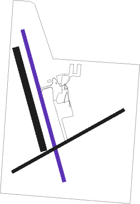
Runway info
| Runway 16 / 34 | ||
| length | 1608m (5276ft) | |
| bearing | 168° / 348° | |
| width | 35m (115ft) | |
| surface | asphalt | |
Runway 05 / 23  | ||
| length | 1309m (4295ft) | |
| bearing | 68° / 248° | |
| width | 33m (107ft) | |
| surface | grass | |
| displ threshold | 77m (253ft) / 0m (0ft) | |
| Runway 16R / 34L | ||
| length | 1054m (3458ft) | |
| bearing | 168° / 348° | |
| width | 65m (213ft) | |
| surface | grass | |
Nearby beacons
| code | identifier | dist | bearing | frequency |
|---|---|---|---|---|
| OK | OAKEY VOR/DME | 49.4 | 187° | 112.90 |
| OK | OAKEY NDB | 50.7 | 187° | 254 |
Instrument approach procedures
| runway | airway (heading) | route (dist, bearing) |
|---|---|---|
| RW16 | KRYNA (147°) | KRYNA 3700ft KRYNI (5mi, 98°) 3700ft |
| RW16 | KRYNC (168°) | KRYNC 3700ft KRYNI (5mi, 168°) 3700ft |
| RW16 | KRYND (189°) | KRYND 3700ft KRYNI (5mi, 242°) 3700ft |
| RNAV | KRYNI 3700ft KRYNF (5mi, 168°) 3380ft KRYNM (5mi, 168°) 1786ft KRYNH (3mi, 168°) (8530mi, 280°) 3700ft | |
| RW34 | KRYSE (325°) | KRYSE 5100ft KRYSI (5mi, 278°) 4700ft |
| RW34 | KRYSG (348°) | KRYSG 5100ft KRYSI (5mi, 348°) 4700ft |
| RW34 | KRYSJ (12°) | KRYSJ 5100ft KRYSI (5mi, 62°) 4700ft |
| RNAV | KRYSI 4700ft KRYSF (5mi, 348°) 3110ft KRYSM (5mi, 348°) 1515ft KRYSH (5mi, 44°) (8535mi, 280°) 3700ft |
Disclaimer
The information on this website is not for real aviation. Use this data with the X-Plane flight simulator only! Data taken with kind consent from X-Plane 12 source code and data files. Content is subject to change without notice.