Lake Cargelligo
Airport details
| Country | Australia |
| State | New South Wales |
| Region | YM |
| Airspace | Melbourne Ctr |
| Municipality | Lake Cargelligo |
| Elevation | 555ft (169m) |
| Timezone | GMT +11 |
| Coordinates | -33.27833, 146.37000 |
| Magnetic var | |
| Type | land |
| Available since | X-Plane v10.40 |
| ICAO code | YLCG |
| IATA code | n/a |
| FAA code | n/a |
Communication
| Lake Cargelligo CTAF | 126.700 |
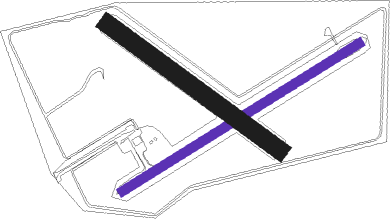
Runway info
| Runway 06 / 24 | ||
| length | 1314m (4311ft) | |
| bearing | 67° / 247° | |
| width | 42m (138ft) | |
| surface | gravel | |
Runway 13 / 31  | ||
| length | 999m (3278ft) | |
| bearing | 126° / 306° | |
| width | 85m (279ft) | |
| surface | grass | |
Nearby beacons
| code | identifier | dist | bearing | frequency |
|---|---|---|---|---|
| GTH | GRIFFITH NDB | 61.9 | 197° | 305 |
Disclaimer
The information on this website is not for real aviation. Use this data with the X-Plane flight simulator only! Data taken with kind consent from X-Plane 12 source code and data files. Content is subject to change without notice.