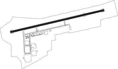
Albury
Airport details
| Country | Australia |
| State | New South Wales |
| Region | YM |
| Airspace | Melbourne Ctr |
| Municipality | Albury |
| Elevation | 539ft (164m) |
| Timezone | GMT +10 |
| Coordinates | -36.06835, 146.96004 |
| Magnetic var | |
| Type | land |
| Available since | X-Plane v10.30 |
| ICAO code | YMAY |
| IATA code | ABX |
| FAA code | n/a |
Communication
| Albury AWIS | 134.525 |
| Albury ATIS | 133.850 |
| Albury CTAF | 123.250 |
| Albury SMC (Ground) | 121.800 |
| Albury Tower | 123.250 |
Nearby Points of Interest:
Commercial Hotel, Albury
-Albury Post Office
-New Albury Hotel
-Elm Court, Albury
-Murray River railway bridge
-Bethanga Bridge
-Gerogery railway station
-Beechworth Asylum
-All Saints Estate Winery
-Corowa Courthouse
-Corowa railway station
Nearby beacons
| code | identifier | dist | bearing | frequency |
|---|---|---|---|---|
| AY | ALBURY VOR/DME | 0.2 | 87° | 115.60 |
| COR | COROWA NDB | 29.6 | 278° | 380 |
| WG | WAGGA WAGGA NDB | 59.5 | 29° | 221 |
| WG | WAGGA WAGGA VOR/DME | 59.6 | 29° | 115 |
Departure and arrival routes
| Transition altitude | 10000ft |
| Transition level | 11000ft |
| SID end points | distance | outbound heading | |
|---|---|---|---|
| RW07 | |||
| UGVER1 | 36mi | 49° | |
| DUGGI1 | 40mi | 224° | |
| RW25 | |||
| UGVER1 | 36mi | 49° | |
| DUGGI1 | 40mi | 224° | |
| STAR starting points | distance | inbound heading | |
|---|---|---|---|
| RW07 | |||
| VEGRU1 | 29.7 | 57° | |
| ARRAN1 | 35.8 | 251° | |
| RW25 | |||
| VEGRU1 | 29.7 | 57° | |
| ARRAN1 | 35.8 | 251° | |
Instrument approach procedures
| runway | airway (heading) | route (dist, bearing) |
|---|---|---|
| RW07-Y | RURLA (100°) | RURLA 3400ft AB2WI (4mi, 146°) 3400ft |
| RW07-Y | UPDUR (58°) | UPDUR 5400ft AB2WI (7mi, 16°) 3400ft |
| RNAV | AB2WI 3400ft AB2WF (5mi, 83°) 1860ft YMAY (5mi, 84°) 589ft AB2WT (3mi, 77°) AB2WH (10mi, 20°) 3400ft | |
| RW07-Z | RURLA (100°) | RURLA 3400ft ABXWI (5mi, 163°) 3400ft |
| RW07-Z | UPDUR (58°) | UPDUR 5400ft ABXWI (6mi, 8°) 3400ft |
| RNAV | ABXWI 3400ft ABXWF (5mi, 79°) 2180ft YMAY (6mi, 80°) 589ft AB2WT (3mi, 77°) AB2WH (10mi, 20°) 3400ft | |
| RW25-Z | AB2EA (243°) | AB2EA 5400ft AB2EI (5mi, 188°) 4500ft |
| RW25-Z | BEMGI (273°) | BEMGI 5400ft AB2EI (5mi, 320°) 4500ft |
| RW25-Z | OLRUT (259°) | OLRUT 5400ft AB2EI (5mi, 259°) 4500ft |
| RNAV | AB2EI 4500ft AB2EF (5mi, 254°) 2810ft YMAY (7mi, 262°) 581ft AB2EH (3mi, 265°) (7965mi, 284°) 3400ft |
Disclaimer
The information on this website is not for real aviation. Use this data with the X-Plane flight simulator only! Data taken with kind consent from X-Plane 12 source code and data files. Content is subject to change without notice.
