Essendon
Airport details
| Country | Australia |
| State | Victoria |
| Region | YM |
| Airspace | Melbourne Ctr |
| Municipality | Melbourne |
| Elevation | 276ft (84m) |
| Timezone | GMT +10 |
| Coordinates | -37.72805, 144.90195 |
| Magnetic var | |
| Type | land |
| Available since | X-Plane v10.40 |
| ICAO code | YMEN |
| IATA code | MEB |
| FAA code | n/a |
Communication
| Essendon YMEN ATIS | 119.800 |
| Essendon ESSENDON Ground Control | 121.900 |
| Essendon ESSENDON Tower | 125.100 |
| Essendon MELBOURNE Approach | 132.000 |
| Essendon MELBOURNE Departure | 118.900 |
Approach frequencies
| ILS-cat-I | RW26 | 109.9 | 18.00mi |
| 3° GS | RW26 | 109.9 | 18.00mi |
Nearby Points of Interest:
Maribyrnong River Viaduct
-HM Prison Pentridge
-Melbourne Showgrounds
-Essendon tram depot
-Brunswick Fire Station and Flats
-Flemington Post Office
-Saltwater River Rail Bridge
-Footscray Town Hall
-Victoria Dock
-Old Physics Conference Room and Gallery
-Baldwin Spencer Building
-Old Pathology Building Melbourne University
-Victorian Trades Hall
-CSIRAC
-Medley Hall
-Emily McPherson College
-Plumbers and Gasfitters Employees Union Building
-Horticultural Hall
-Cairo Flats
-Melbourne Mint
-Working Men's College of Melbourne
-Spencer Street Power Station
-State Library Victoria
-Royal Society of Victoria
-Storey Hall
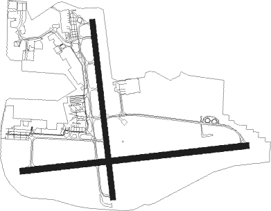
Runway info
Runway 17 / 35  | ||
| length | 1505m (4938ft) | |
| bearing | 177° / 357° | |
| width | 45m (148ft) | |
| surface | asphalt | |
| blast zone | 0m (0ft) / 87m (285ft) | |
| Runway 08 / 26 | ||
| length | 1918m (6293ft) | |
| bearing | 88° / 268° | |
| width | 50m (164ft) | |
| surface | asphalt | |
Nearby beacons
| code | identifier | dist | bearing | frequency |
|---|---|---|---|---|
| ML | MELBOURNE VOR/DME | 4.9 | 319° | 114.10 |
| MB | MOORABBIN (MELBOURNE) NDB | 17.3 | 143° | 398 |
| AV | AVALON VOR/DME | 28.4 | 234° | 116.10 |
| MNG | MANGALORE VOR | 52.4 | 19° | 113.20 |
Instrument approach procedures
| runway | airway (heading) | route (dist, bearing) |
|---|---|---|
| RW17 | MENNE (203°) | MENNE 3000ft MENNI (5mi, 252°) 3000ft |
| RW17 | MENNG (177°) | MENNG 3000ft MENNI (5mi, 177°) 3000ft |
| RNAV | MENNI 3000ft MENNF (5mi, 177°) 2010ft YMEN (6mi, 177°) 332ft MENNH (2mi, 125°) (7827mi, 285°) 3000ft | |
| RW26 | ATIBO (269°) | ATIBO 3000ft MONTY (5mi, 268°) 3000ft |
| RW26 | MENEA (248°) | MENEA 5000ft MONTY (6mi, 202°) 3000ft |
| RW26 | MENEC (287°) | MENEC 3000ft MONTY (5mi, 333°) 3000ft |
| RNAV | MONTY 3000ft MENEF (4mi, 268°) 1880ft YMEN (6mi, 270°) 290ft MENEH (6mi, 129°) (7827mi, 285°) 3000ft |
Disclaimer
The information on this website is not for real aviation. Use this data with the X-Plane flight simulator only! Data taken with kind consent from X-Plane 12 source code and data files. Content is subject to change without notice.