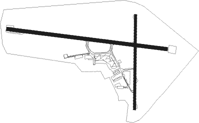
Mildura
Airport details
| Country | Australia |
| State | Victoria |
| Region | YM |
| Airspace | Melbourne Ctr |
| Municipality | Mildura |
| Elevation | 166ft (51m) |
| Timezone | GMT +10 |
| Coordinates | -34.22917, 142.08556 |
| Magnetic var | |
| Type | land |
| Available since | X-Plane v11.51r1 |
| ICAO code | YMIA |
| IATA code | MQL |
| FAA code | n/a |
Communication
| Mildura AWIS | 128.675 |
| Mildura MILDURA MULT | 118.800 |
| Mildura ACTIVATE LIGHTS ONLY MULT | 119.600 |
| Mildura MELBOURNE CNTR | 122.100 |
Nearby Points of Interest:
Saint Ignatius School
-St John's Anglican Church, Wentworth
Nearby beacons
| code | identifier | dist | bearing | frequency |
|---|---|---|---|---|
| MIA | MILDURA VOR/DME | 0.4 | 296° | 113.70 |
| MIA | MILDURA NDB | 1.2 | 212° | 272 |
Instrument approach procedures
| runway | airway (heading) | route (dist, bearing) |
|---|---|---|
| RW09-Z | MIAWJ (83°) | MIAWJ 2000ft MIAWI (5mi, 37°) 2000ft |
| RW09-Z | MIAWK (100°) | MIAWK 2000ft MIAWI (5mi, 100°) 2000ft |
| RW09-Z | MIAWL (118°) | MIAWL 2000ft MIAWI (5mi, 170°) 2000ft |
| RNAV | MIAWI 2000ft MIAWF (5mi, 100°) 1890ft YMIA (6mi, 100°) 217ft MIAWH (2mi, 99°) (7852mi, 284°) 2000ft | |
| RW18-Z | MIANN (162°) | MIANN 2000ft MIANI (5mi, 111°) 2000ft |
| RW18-Z | MIANO (187°) | MIANO 2000ft MIANI (5mi, 186°) 2000ft |
| RW18-Z | MIANP (211°) | MIANP 2000ft MIANI (5mi, 257°) 2000ft |
| RNAV | MIANI 2000ft MIANF (5mi, 186°) 1890ft YMIA (6mi, 188°) 212ft MIANH (3mi, 181°) (7849mi, 284°) 2000ft | |
| RW27-Z | MIAEA (262°) | MIAEA 2000ft MIAEI (5mi, 217°) 2000ft |
| RW27-Z | MIAEB (280°) | MIAEB 2000ft MIAEI (5mi, 280°) 2000ft |
| RW27-Z | MIAEC (298°) | MIAEC 2000ft MIAEI (5mi, 350°) 2000ft |
| RNAV | MIAEI 2000ft MIAEF (5mi, 280°) 1890ft YMIA (6mi, 279°) 211ft MIAEH (2mi, 281°) (7849mi, 284°) 2000ft | |
| RW36-Z | MIASD (340°) | MIASD 2000ft MIASI (5mi, 291°) 2000ft |
| RW36-Z | MIASE (5°) | MIASE 2000ft MIASI (5mi, 6°) 2000ft |
| RW36-Z | MIASG (29°) | MIASG 2000ft MIASI (5mi, 78°) 2000ft |
| RNAV | MIASI 2000ft MIASF (5mi, 6°) 1890ft YMIA (6mi, 4°) 215ft MIASH (2mi, 12°) (7852mi, 284°) 2000ft |
Disclaimer
The information on this website is not for real aviation. Use this data with the X-Plane flight simulator only! Data taken with kind consent from X-Plane 12 source code and data files. Content is subject to change without notice.

