Mittagong
Airport details
| Country | Australia |
| State | New South Wales |
| Region | YM |
| Airspace | Melbourne Ctr |
| Municipality | Mittagong |
| Elevation | 1889ft (576m) |
| Timezone | GMT +11 |
| Coordinates | -34.44833, 150.50333 |
| Magnetic var | |
| Type | land |
| Available since | X-Plane v10.40 |
| ICAO code | YMIG |
| IATA code | n/a |
| FAA code | n/a |
Communication
| Mittagong CTAF | 126.700 |
Nearby Points of Interest:
Mittagong railway station
-Berrima Correctional Centre
-Moss Vale railway station
-Nepean Dam
-Mount Broughton
-Bargo railway viaduct
-Upper Nepean Scheme
-Picton railway station
-Stonequarry Creek railway viaduct, Picton
-St Stephen's Presbyterian Church, Jamberoo
-Wollongong railway station
-Dunmore railway station
-Bombo railway station
-Kiama railway station
-Kiama Masonic Temple
-Wingello railway station
-Beulah
-Menangle Railway Bridge
-Camden Park Estate
-Bomaderry Aboriginal Children's Home
-Graham Lodge
-Tallong railway station
-Studley Park
-Camelot, Kirkham
-Stanwell Park Rail Viaduct over Stanwell Creek
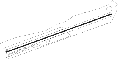
Runway info
| Runway 06 / 24 | ||
| length | 1197m (3927ft) | |
| bearing | 77° / 257° | |
| width | 10m (33ft) | |
| surface | asphalt | |
Nearby beacons
| code | identifier | dist | bearing | frequency |
|---|---|---|---|---|
| WOL | WOLLONGONG NDB | 15.6 | 111° | 239 |
| NWA | NOWRA TACAN | 30.1 | 177° | 116.40 |
| NWA | NOWRA NDB | 30.2 | 177° | 359 |
| BK | BANKSTOWN (SYDNEY) NDB | 39.4 | 43° | 416 |
| GLB | GOULBURN NDB | 43.5 | 245° | 407 |
| SY | DME | 45.3 | 53° | 112.10 |
| RIC | RICHMOND TACAN | 52.6 | 19° | 110.70 |
| RIC | RICHMOND NDB | 52.9 | 18° | 347 |
Disclaimer
The information on this website is not for real aviation. Use this data with the X-Plane flight simulator only! Data taken with kind consent from X-Plane 12 source code and data files. Content is subject to change without notice.