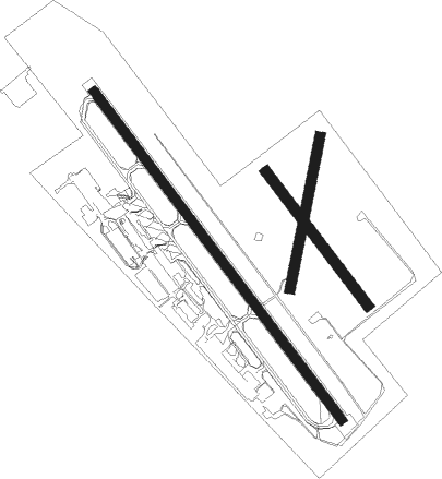
Launceston
Airport details
| Country | Australia |
| State | Tasmania |
| Region | YM |
| Airspace | Melbourne Ctr |
| Municipality | Western Junction |
| Elevation | 562ft (171m) |
| Timezone | GMT +10 |
| Coordinates | -41.54947, 147.21281 |
| Magnetic var | |
| Type | land |
| Available since | X-Plane v10.40 |
| ICAO code | YMLT |
| IATA code | LST |
| FAA code | n/a |
Communication
| Launceston Launy ATIS | 134.750 |
| Launceston ACTIVATE LIGHTS ONLY MULT | 120.600 |
| Launceston LAUNCESTON MULT | 118.700 |
| Launceston LAUNY Tower | 118.700 |
| Launceston MELBOURNE CNTR | 126.500 |
Approach frequencies
| ILS-cat-I | RW32L | 109.5 | 18.00mi |
| 3° GS | RW32L | 109.5 | 18.00mi |
Nearby Points of Interest:
Longford Railway Bridge
-St Andrew's Kirk, Launceston
-Albert Hall
-Launceston Gasworks
Nearby beacons
| code | identifier | dist | bearing | frequency |
|---|---|---|---|---|
| LT | LAUNCESTON VOR/DME | 0.3 | 4° | 112.60 |
| LT | LAUNCESTON (LAUNCESTON, TAS) NDB | 0.8 | 133° | 242 |
Departure and arrival routes
| Transition altitude | 10000ft |
| Transition level | 11000ft |
| SID end points | distance | outbound heading | |
|---|---|---|---|
| RW14R | |||
| NUNP1B, NUNP1A | 95mi | 29° | |
| MOTR1B, MOTR1A | 50mi | 79° | |
| KAREN2 | 38mi | 140° | |
| TASUM1 | 79mi | 166° | |
| MORGO1 | 38mi | 192° | |
| IRONS2 | 36mi | 253° | |
| IRSO1A | 42mi | 296° | |
| ONAG1B, ONAG1A | 199mi | 333° | |
| NOLA5B, NOLA5A | 54mi | 359° | |
| RW32L | |||
| NUNP1A | 95mi | 29° | |
| MOTR1A | 50mi | 79° | |
| KAREN2 | 38mi | 140° | |
| TASUM1 | 79mi | 166° | |
| MORGO1 | 38mi | 192° | |
| IRONS2 | 36mi | 253° | |
| IRSO1A | 42mi | 296° | |
| ONAG1A | 199mi | 333° | |
| NOLA5A | 54mi | 359° | |
Instrument approach procedures
| runway | airway (heading) | route (dist, bearing) |
|---|---|---|
| RW14RZ | MLTND (120°) | MLTND 4000ft MLTNI (5mi, 80°) 3790ft |
| RW14RZ | MLTNE (140°) | MLTNE 4000ft MLTNI (5mi, 139°) 3790ft |
| RW14RZ | MLTNG (172°) | MLTNG 5800ft MLTNI (7mi, 225°) 3790ft |
| RNAV | MLTNI 3790ft MLTNF (5mi, 140°) 2200ft YMLT (6mi, 140°) 610ft ISMIR (7mi, 139°) 2500ft | |
| RW32LZ | MLTSA (298°) | MLTSA 6300ft MLTSI (6mi, 260°) 4480ft |
| RW32LZ | MLTSB (319°) | MLTSB 5800ft MLTSI (5mi, 319°) 4480ft |
| RW32LZ | MLTSC (341°) | MLTSC 5800ft MLTSI (5mi, 45°) 4480ft |
| RNAV | MLTSI 4480ft MLTSF (5mi, 319°) 2890ft YMLT (7mi, 319°) 598ft MLTSH (3mi, 321°) (7747mi, 286°) 3200ft |
Disclaimer
The information on this website is not for real aviation. Use this data with the X-Plane flight simulator only! Data taken with kind consent from X-Plane 12 source code and data files. Content is subject to change without notice.

