Melbourne - Melbourne Moorabbin
Airport details
| Country | Australia |
| State | Victoria |
| Region | YM |
| Airspace | Melbourne Ctr |
| Municipality | Melbourne |
| Elevation | 46ft (14m) |
| Timezone | GMT +10 |
| Coordinates | -37.97966, 145.09483 |
| Magnetic var | |
| Type | land |
| Available since | X-Plane v10.40 |
| ICAO code | YMMB |
| IATA code | MBW |
| FAA code | n/a |
Communication
| Melbourne Moorabbin ATIS | 120.900 |
| Melbourne Moorabbin Moorabbin CTAF | 118.100 |
| Melbourne Moorabbin Ground Control | 119.900 |
| Melbourne Moorabbin Tower | 123.000 |
| Melbourne Moorabbin Tower | 118.100 |
| Melbourne Moorabbin Melbourne Centre | 135.700 |
| Melbourne Moorabbin Melbourne Radar | 119.900 |
Nearby Points of Interest:
Waverley Park
-Glen Eira Town Hall
-Elsternwick Metropolitan Fire Brigade Station
-Rippon Lea Estate
-Malvern Presbyterian Church, Melbourne
-Malvern tram depot
-Stonnington City Centre
-Stonington mansion
-St Kilda Hebrew Congregation Synagogue
-Rivoli Cinema
-Prahran Town Hall
-Toorak House
-Prahran Mechanics' Institute
-Rechabite Hall
-Junction Oval
-St Kilda Pavilion
-Victorian College For The Deaf
-Newburn Flats
-Richmond Power Station
-Airlie
-Bryant and May Factory
-Nylex Clock
-Melbourne Observatory
-Melbourne Sports and Entertainment Centre
-Olympic Pylon
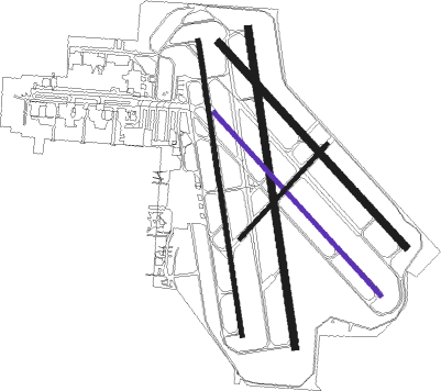
Runway info
Runway 17L / 35R  | ||
| length | 1341m (4400ft) | |
| bearing | 175° / 355° | |
| width | 30m (98ft) | |
| surface | asphalt | |
| displ threshold | 288m (945ft) / 178m (584ft) | |
| Runway 17R / 35L | ||
| length | 1243m (4078ft) | |
| bearing | 175° / 355° | |
| width | 18m (59ft) | |
| surface | asphalt | |
| displ threshold | 196m (643ft) / 156m (512ft) | |
| Runway 13L / 31R | ||
| length | 1150m (3773ft) | |
| bearing | 135° / 315° | |
| width | 30m (98ft) | |
| surface | asphalt | |
| displ threshold | 110m (361ft) / 0m (0ft) | |
| Runway 13R / 31L | ||
| length | 1029m (3376ft) | |
| bearing | 135° / 315° | |
| width | 18m (59ft) | |
| surface | asphalt | |
| displ threshold | 137m (449ft) / 146m (479ft) | |
| Runway 04 / 22 | ||
| length | 535m (1755ft) | |
| bearing | 54° / 234° | |
| width | 18m (59ft) | |
| surface | asphalt | |
| displ threshold | 0m (0ft) / 65m (213ft) | |
Nearby beacons
| code | identifier | dist | bearing | frequency |
|---|---|---|---|---|
| MB | MOORABBIN (MELBOURNE) NDB | 0.2 | 306° | 398 |
| ML | MELBOURNE VOR/DME | 22.6 | 322° | 114.10 |
| AV | AVALON VOR/DME | 30.3 | 264° | 116.10 |
Instrument approach procedures
| runway | airway (heading) | route (dist, bearing) |
|---|---|---|
| RW17L | HARRO (223°) | HARRO 4700ft MMBNI (9mi, 266°) 3300ft |
| RW17L | MMBNG (151°) | MMBNG 3300ft MMBNI (5mi, 103°) 3300ft |
| RW17L | MONTY (184°) | MONTY 4700ft MMBNI (5mi, 201°) 3300ft |
| RNAV | MMBNI 3300ft MMBNF (5mi, 175°) 1890ft MMBNM (5mi, 175°) 304ft MMBNH (3mi, 175°) (7823mi, 285°) 2200ft | |
| RW35R | MMBSA (20°) | MMBSA 2600ft MMBSI (5mi, 71°) 2600ft |
| RW35R | MMBSB (354°) | MMBSB 2600ft MMBSI (5mi, 355°) 2600ft |
| RW35R | MMBSC (328°) | MMBSC 2600ft MMBSI (5mi, 283°) 2600ft |
| RNAV | MMBSI 2600ft MMBSF (5mi, 355°) 1790ft YMMB (6mi, 352°) 85ft MMBSH (6mi, 114°) (7826mi, 285°) 2200ft |
Disclaimer
The information on this website is not for real aviation. Use this data with the X-Plane flight simulator only! Data taken with kind consent from X-Plane 12 source code and data files. Content is subject to change without notice.