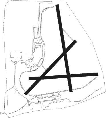
Point Cook
Airport details
| Country | Australia |
| State | Victoria |
| Region | YM |
| Airspace | Melbourne Ctr |
| Municipality | Melbourne |
| Elevation | 14ft (4m) |
| Timezone | GMT +10 |
| Coordinates | -37.93268, 144.74986 |
| Magnetic var | |
| Type | land |
| Available since | X-Plane v10.40 |
| ICAO code | YMPC |
| IATA code | n/a |
| FAA code | n/a |
Communication
| Point Cook POINT COOK CTAF | 126.200 |
Nearby Points of Interest:
Newport Workshops
-Williamstown Lighthouse
-Station Pier
-Port Melbourne railway station
-Footscray Town Hall
-Victoria Dock
-St Kilda Pavilion
-Saltwater River Rail Bridge
-South Melbourne Town Hall
-Polly Woodside
-Melbourne Showgrounds
-67 Spencer Street
-Junction Oval
-Spencer Street Power Station
-Maribyrnong River Viaduct
-Newburn Flats
-St Kilda Hebrew Congregation Synagogue
-Rialto Towers
-Victorian College For The Deaf
-140 William Street
-Lombard Building
-Alkira House
-Melbourne Mint
-Former Bank of Australasia
-Victoria Barracks, Melbourne
Nearby beacons
| code | identifier | dist | bearing | frequency |
|---|---|---|---|---|
| AV | AVALON VOR/DME | 15.4 | 248° | 116.10 |
| MB | MOORABBIN (MELBOURNE) NDB | 16.3 | 97° | 398 |
| ML | MELBOURNE VOR/DME | 16.9 | 19° | 114.10 |
Instrument approach procedures
| runway | airway (heading) | route (dist, bearing) |
|---|---|---|
| RW35 | MPZSD (327°) | MPZSD 2200ft MPZSI (5mi, 282°) 2200ft |
| RW35 | MPZSE (353°) | MPZSE 2200ft MPZSI (5mi, 354°) 2200ft |
| RW35 | MPZSG (20°) | MPZSG 2200ft MPZSI (5mi, 70°) 2200ft |
| RNAV | MPZSI 2200ft MPZSF (5mi, 354°) 1650ft YMPC (5mi, 354°) 58ft MPZSH (5mi, 128°) (7814mi, 285°) 2200ft |
Disclaimer
The information on this website is not for real aviation. Use this data with the X-Plane flight simulator only! Data taken with kind consent from X-Plane 12 source code and data files. Content is subject to change without notice.

