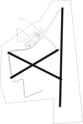
Mount Gambier
Airport details
| Country | Australia |
| State | South Australia |
| Region | YM |
| Airspace | Melbourne Ctr |
| Municipality | The District Council of Grant |
| Elevation | 208ft (63m) |
| Timezone | GMT +9.5 |
| Coordinates | -37.74556, 140.78528 |
| Magnetic var | |
| Type | land |
| Available since | X-Plane v10.40 |
| ICAO code | YMTG |
| IATA code | MGB |
| FAA code | n/a |
Communication
| Mount Gambier AWOS | 133.425 |
| Mount Gambier Mount Gambier CTAF | 126.650 |
Nearby Points of Interest:
Casterton railway station
Nearby beacons
| code | identifier | dist | bearing | frequency |
|---|---|---|---|---|
| MTG | MOUNT GAMBIER VOR | 0.3 | 180° | 117 |
| MTG | MOUNT GAMBIER NDB | 0.5 | 222° | 266 |
Instrument approach procedures
| runway | airway (heading) | route (dist, bearing) |
|---|---|---|
| RW18-Z | MTGND (213°) | MTGND 2500ft MTGNI (5mi, 259°) 2500ft |
| RW18-Z | MTGNE (188°) | MTGNE 2500ft MTGNI (5mi, 187°) 2500ft |
| RW18-Z | MTGNG (162°) | MTGNG 2500ft MTGNI (5mi, 111°) 2500ft |
| RNAV | MTGNI 2500ft MTGNF (5mi, 187°) 1940ft YMTG (6mi, 190°) 262ft MTGNH (2mi, 182°) (7673mi, 285°) 2500ft | |
| RW36-Z | MTGSA (31°) | MTGSA 2500ft MTGSI (5mi, 79°) 2500ft |
| RW36-Z | MTGSB (6°) | MTGSB 2500ft MTGSI (5mi, 7°) 2500ft |
| RW36-Z | MTGSC (341°) | MTGSC 2500ft MTGSI (5mi, 291°) 2500ft |
| RNAV | MTGSI 2500ft MTGSF (5mi, 7°) 1900ft YMTG (6mi, 5°) 244ft MTGSH (2mi, 13°) (7676mi, 285°) 2500ft |
Disclaimer
The information on this website is not for real aviation. Use this data with the X-Plane flight simulator only! Data taken with kind consent from X-Plane 12 source code and data files. Content is subject to change without notice.

