Nanango
Airport details
| Country | Australia |
| State | Queensland |
| Region | YB |
| Airspace | Brisbane Ctr |
| Municipality | South Burnett Regional |
| Elevation | 1193ft (364m) |
| Timezone | GMT +10 |
| Coordinates | -26.69293, 151.98421 |
| Magnetic var | |
| Type | land |
| Available since | X-Plane v10.40 |
| ICAO code | YNAN |
| IATA code | n/a |
| FAA code | n/a |
Communication
| Nanango CTAF | 126.700 |
Nearby Points of Interest:
Nanango Court House
-Nanango Butter Factory Building
-Taromeo Homestead
-St Michael and All Angels Church, Kingaroy
-Kingaroy Peanut Silos
-Taabinga Homestead
-Linville War Memorial
-Harlin Rail Bridge
-Yimbun Railway Tunnel
-Goomeri Hall of Memory
-Goomeri War Memorial Clock
-Cressbrook Homestead
-St Andrew's Church Hall, Toogoolawah
-St Andrew's Rectory, Toogoolawah
-Toogoolawah War Memorial
-Mount Clara chimney
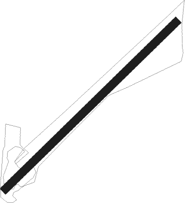
Runway info
| Runway 5 / 23 | ||
| length | 1189m (3901ft) | |
| bearing | 53° / 233° | |
| width | 40m (131ft) | |
| surface | grass | |
| blast zone | 18m (59ft) / 18m (59ft) | |
Nearby beacons
| code | identifier | dist | bearing | frequency |
|---|---|---|---|---|
| OK | OAKEY VOR/DME | 44.4 | 199° | 112.90 |
| OK | OAKEY NDB | 45.6 | 199° | 254 |
| AMB | AMBERLEY TACAN | 69.1 | 142° | 108.10 |
Disclaimer
The information on this website is not for real aviation. Use this data with the X-Plane flight simulator only! Data taken with kind consent from X-Plane 12 source code and data files. Content is subject to change without notice.