Narrabri
Airport details
| Country | Australia |
| State | New South Wales |
| Region | YB |
| Airspace | Brisbane Ctr |
| Municipality | Narrabri |
| Elevation | 788ft (240m) |
| Timezone | GMT +10 |
| Coordinates | -30.32012, 149.82771 |
| Magnetic var | |
| Type | land |
| Available since | X-Plane v10.40 |
| ICAO code | YNBR |
| IATA code | NAA |
| FAA code | n/a |
Communication
Nearby Points of Interest:
Narrabri Post Office and former Telegraph Office
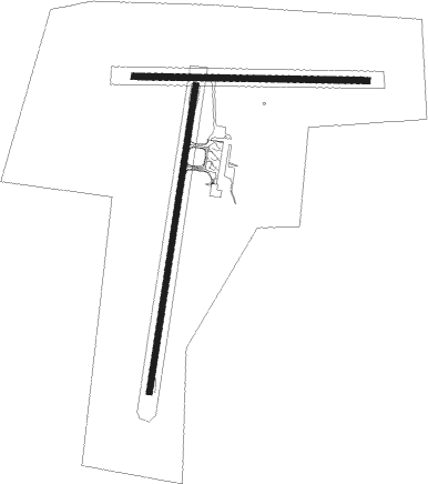
Runway info
Runway 18 / 36  | ||
| length | 1527m (5010ft) | |
| bearing | 195° / 15° | |
| width | 27m (89ft) | |
| surface | asphalt | |
| Runway 09 / 27 | ||
| length | 1150m (3773ft) | |
| bearing | 95° / 275° | |
| width | 30m (98ft) | |
| surface | grass | |
Nearby beacons
| code | identifier | dist | bearing | frequency |
|---|---|---|---|---|
| NBR | NARRABRI NDB | 0.1 | 100° | 413 |
| GDH | GUNNEDAH NDB | 43.8 | 146° | 407 |
| MOR | MOREE NDB | 49.4 | 2° | 392 |
Instrument approach procedures
| runway | airway (heading) | route (dist, bearing) |
|---|---|---|
| RW36 | NBRSA (352°) | NBRSA 5500ft NBRSI (5mi, 299°) 4000ft |
| RW36 | NBRSB (15°) | NBRSB 5500ft NBRSI (5mi, 15°) 4000ft |
| RW36 | NBRSC (38°) | NBRSC 5500ft NBRSI (5mi, 84°) 4000ft |
| RNAV | NBRSI 4000ft NBRSF (5mi, 15°) 2400ft YNBR (6mi, 16°) 767ft NBRSH (2mi, 13°) (8306mi, 281°) 5500ft |
Disclaimer
The information on this website is not for real aviation. Use this data with the X-Plane flight simulator only! Data taken with kind consent from X-Plane 12 source code and data files. Content is subject to change without notice.