Nhill
Airport details
| Country | Australia |
| State | Victoria |
| Region | YM |
| Airspace | Melbourne Ctr |
| Municipality | Shire of Hindmarsh |
| Elevation | 454ft (138m) |
| Timezone | GMT +11 |
| Coordinates | -36.30972, 141.64084 |
| Magnetic var | |
| Type | land |
| Available since | X-Plane v10.40 |
| ICAO code | YNHL |
| IATA code | n/a |
| FAA code | n/a |
Communication
| Nhill CTAF | 126.700 |
Nearby Points of Interest:
Serviceton railway station
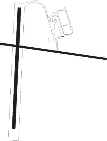
Runway info
Runway 09 / 27  | ||
| length | 997m (3271ft) | |
| bearing | 100° / 280° | |
| width | 18m (59ft) | |
| surface | asphalt | |
| Runway 18 / 36 | ||
| length | 1117m (3665ft) | |
| bearing | 189° / 9° | |
| width | 31m (101ft) | |
| surface | grass | |
Nearby beacons
| code | identifier | dist | bearing | frequency |
|---|---|---|---|---|
| BOR | BORDERTOWN NDB | 43.2 | 265° | 251 |
Instrument approach procedures
| runway | airway (heading) | route (dist, bearing) |
|---|---|---|
| RW09-Z | NHLWD (82°) | NHLWD 2500ft NHLWI (5mi, 38°) 2500ft |
| RW09-Z | NHLWE (100°) | NHLWE 2500ft NHLWI (5mi, 100°) 2500ft |
| RW09-Z | NHLWG (119°) | NHLWG 2500ft NHLWI (5mi, 171°) 2500ft |
| RNAV | NHLWI 2500ft NHLWF (5mi, 100°) 2070ft NHLWM (5mi, 100°) 478ft NHLWH (4mi, 100°) (7761mi, 284°) 2500ft | |
| RW27-Z | NHLEA (254°) | NHLEA 2500ft NHLEI (5mi, 204°) 2500ft |
| RW27-Z | NHLEB (270°) | NHLEB 2500ft NHLEI (5mi, 270°) 2500ft |
| RW27-Z | NHLEC (287°) | NHLEC 2500ft NHLEI (5mi, 335°) 2500ft |
| RNAV | NHLEI 2500ft NHLEF (5mi, 270°) 2330ft NHLEM (5mi, 270°) 736ft NHLEH (3mi, 270°) (7757mi, 284°) 2500ft |
Disclaimer
The information on this website is not for real aviation. Use this data with the X-Plane flight simulator only! Data taken with kind consent from X-Plane 12 source code and data files. Content is subject to change without notice.