Narromine
Airport details
| Country | Australia |
| State | New South Wales |
| Region | YM |
| Airspace | Melbourne Ctr |
| Municipality | Narromine |
| Elevation | 782ft (238m) |
| Timezone | GMT +11 |
| Coordinates | -32.21763, 148.22029 |
| Magnetic var | |
| Type | land |
| Available since | X-Plane v10.40 |
| ICAO code | YNRM |
| IATA code | QRM |
| FAA code | n/a |
Communication
| Narromine CTAF | 126.700 |
Nearby Points of Interest:
Macquarie River Railway Bridge, Dubbo
-Colonial Mutual Life building, Dubbo
-Dubbo RAAF Stores Depot
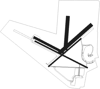
Runway info
Runway 11 / 29  | ||
| length | 1517m (4977ft) | |
| bearing | 117° / 297° | |
| width | 30m (98ft) | |
| surface | asphalt | |
| displ threshold | 0m (0ft) / 255m (837ft) | |
| Runway 04 / 22 | ||
| length | 1101m (3612ft) | |
| bearing | 58° / 238° | |
| width | 30m (98ft) | |
| surface | asphalt | |
| displ threshold | 82m (269ft) / 0m (0ft) | |
| Runway 04L / 22R | ||
| length | 1038m (3406ft) | |
| bearing | 58° / 238° | |
| width | 90m (295ft) | |
| surface | grass | |
| Runway 11L / 29R | ||
| length | 817m (2680ft) | |
| bearing | 118° / 298° | |
| width | 60m (197ft) | |
| surface | grass | |
| Runway 18 / 36 | ||
| length | 796m (2612ft) | |
| bearing | 190° / 10° | |
| width | 90m (295ft) | |
| surface | grass | |
Nearby beacons
| code | identifier | dist | bearing | frequency |
|---|---|---|---|---|
| DU | DUBBO NDB | 17.2 | 90° | 251 |
| PKS | PARKES VOR/DME | 54.8 | 179° | 112 |
| PKS | PARKES NDB | 55.7 | 178° | 242 |
Instrument approach procedures
| runway | airway (heading) | route (dist, bearing) |
|---|---|---|
| RW11-Z | NRMWA (100°) | NRMWA 3700ft NRMWI (5mi, 56°) 3700ft |
| RW11-Z | NRMWB (118°) | NRMWB 3700ft NRMWI (5mi, 118°) 3700ft |
| RW11-Z | NRMWC (139°) | NRMWC 3700ft NRMWI (5mi, 193°) 3700ft |
| RNAV | NRMWI 3700ft NRMWF (5mi, 117°) 2500ft NRMWM (5mi, 117°) 910ft NRMWT (3mi, 117°) NRMWH (8mi, 222°) 3000ft (8161mi, 282°) 3700ft |
Disclaimer
The information on this website is not for real aviation. Use this data with the X-Plane flight simulator only! Data taken with kind consent from X-Plane 12 source code and data files. Content is subject to change without notice.