Perth - Jandakot
Airport details
| Country | Australia |
| State | Western Australia |
| Region | YM |
| Airspace | Melbourne Ctr |
| Municipality | City Of Cockburn |
| Elevation | 99ft (30m) |
| Timezone | GMT +8 |
| Coordinates | -32.09246, 115.88549 |
| Magnetic var | |
| Type | land |
| Available since | X-Plane v10.40 |
| ICAO code | YPJT |
| IATA code | JAD |
| FAA code | n/a |
Communication
| Jandakot YPJT ATIS | 128.650 |
| Jandakot JANDAKOT MULTICOM | 118.100 |
| Jandakot ACTIVATE LIGHTS ONLY MULTICOM | 123.900 |
| Jandakot PERTH Clearance | 135.250 |
| Jandakot JANDAKOT Ground Control | 124.300 |
| Jandakot JANDAKOT Tower | 118.100 |
| Jandakot JANDAKOT Tower | 119.400 |
| Jandakot PERTH Approach | 123.700 |
| Jandakot PERTH Approach | 128.100 |
| Jandakot PERTH Approach | 127.500 |
| Jandakot PERTH Departure | 128.100 |
| Jandakot PERTH Departure | 118.700 |
Nearby Points of Interest:
Riverton Bridge
-Castledare Boys' Home
-Kent Street Weir
-Canning Bridge
-Coogee Hotel, Western Australia
-Newmarket Hotel
-Carlisle railway station
-Fremantle Grammar School
-Victoria Park Post Office
-Lathlain railway station
-Hampton Buildings
-Stirling Bridge
-Fremantle Synagogue
-Fremantle Markets
-Canning Contour Channel (former)
-Fremantle Technical School building
-Metropolis Fremantle
-South Perth Post Office
-the federal boutique hotel
-Dalgety Wool Stores
-Evan Davies Building
-Oceanic Hotel
-Fremantle Trades Hall
-Higham's Buildings
-RSL Club (Fremantle)
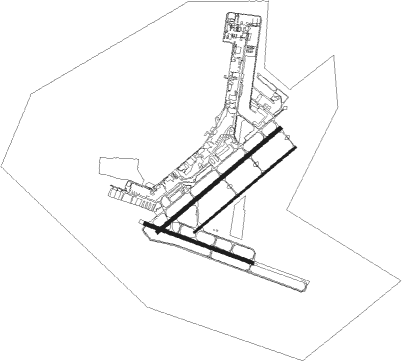
Runway info
Runway 12 / 30  | ||
| length | 995m (3264ft) | |
| bearing | 111° / 291° | |
| width | 30m (98ft) | |
| surface | asphalt | |
| Runway 06L / 24R | ||
| length | 1393m (4570ft) | |
| bearing | 59° / 239° | |
| width | 30m (98ft) | |
| surface | asphalt | |
| displ threshold | 118m (387ft) / 147m (482ft) | |
| Runway 06R / 24L | ||
| length | 1151m (3776ft) | |
| bearing | 59° / 239° | |
| width | 19m (62ft) | |
| surface | asphalt | |
Nearby beacons
| code | identifier | dist | bearing | frequency |
|---|---|---|---|---|
| JT | JANDAKOT NDB | 0.6 | 173° | 281 |
| PH | PERTH VOR/DME | 9.6 | 27° | 113.70 |
| PEA | PEARCE TACAN | 26 | 18° | 112.80 |
| PEA | PEARCE NDB | 27.1 | 17° | 340 |
| GIG | GINGIN NDB | 38 | 358° | 372 |
Departure and arrival routes
| Transition altitude | 10000ft |
| Transition level | 11000ft |
| STAR starting points | distance | inbound heading | |
|---|---|---|---|
| ALL | |||
| JT2R | 25.7 | 230° | |
| JT2G | 10.2 | 264° | |
Instrument approach procedures
| runway | airway (heading) | route (dist, bearing) |
|---|---|---|
| RW06LZ | PJTWA (34°) | PJTWA 1900ft PJTWI (4mi, 320°) 1900ft |
| RW06LZ | PJTWB (80°) | PJTWB 1900ft PJTWI (4mi, 140°) 1900ft |
| RNAV | PJTWI 1900ft PJTWF (4mi, 59°) 1500ft PJTWM (4mi, 59°) 232ft (6708mi, 285°) 500ft PJTWH (6708mi, 106°) 1500ft (6708mi, 286°) 1900ft | |
| RW24RZ | KALAM (244°) | KALAM 3100ft PJTEI (5mi, 255°) 3100ft |
| RW24RZ | PJTED (219°) | PJTED 3100ft PJTEI (5mi, 162°) 3100ft |
| RW24RZ | PJTEG (257°) | PJTEG 3100ft PJTEI (5mi, 300°) 3100ft |
| RNAV | PJTEI 3100ft PJTEF (5mi, 239°) 2070ft YPJT (6mi, 239°) 145ft (6709mi, 285°) 500ft PJTEH (6703mi, 105°) 1500ft (6703mi, 285°) 1900ft | |
| RW30-Z | PJTSK (296°) | PJTSK 3100ft PJTSI (5mi, 294°) 3100ft |
| RW30-Z | PJTSL (317°) | PJTSL 3100ft PJTSI (5mi, 9°) 3100ft |
| RNAV | PJTSI 3100ft PJTSF (5mi, 294°) 1740ft YPJT (5mi, 300°) 147ft (6709mi, 285°) 600ft PJTSH (6703mi, 105°) 1500ft (6703mi, 285°) 1900ft |
Holding patterns
| STAR name | hold at | type | turn | heading* | altitude | leg | speed limit |
|---|---|---|---|---|---|---|---|
| JT2W | HAMTN | VHF | right | 107 (287)° | 20000ft - 60000ft | 1.5min timed | ICAO rules |
| *) magnetic outbound (inbound) holding course | |||||||
Disclaimer
The information on this website is not for real aviation. Use this data with the X-Plane flight simulator only! Data taken with kind consent from X-Plane 12 source code and data files. Content is subject to change without notice.