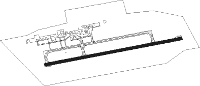
Karratha
Airport details
| Country | Australia |
| State | Western Australia |
| Region | YM |
| Airspace | Melbourne Ctr |
| Municipality | City Of Karratha |
| Elevation | 33ft (10m) |
| Timezone | GMT +8 |
| Coordinates | -20.70987, 116.76702 |
| Magnetic var | |
| Type | land |
| Available since | X-Plane v10.40 |
| ICAO code | YPKA |
| IATA code | KTA |
| FAA code | n/a |
Communication
| Karratha ATIS | 134.550 |
| Karratha CTAF | 127.350 |
| Karratha SMC | 123.550 |
| Karratha Tower | 127.350 |
| Karratha ML_CEN | 122.400 |
Nearby Points of Interest:
Roebourne
Nearby beacons
| code | identifier | dist | bearing | frequency |
|---|---|---|---|---|
| KA | KARRATHA VOR/DME | 0.4 | 127° | 117.30 |
| KA | KARRATHA NDB | 0.9 | 77° | 404 |
Instrument approach procedures
| runway | airway (heading) | route (dist, bearing) |
|---|---|---|
| RW08-U | GITSM (262°) | GITSM 4500ft KA922 (2mi, 260°) 4500ft KA918 (9mi, 234°) 4500ft KA910 (5mi, 259°) 3700ft MURAY (2mi, 334°) 3000ft KA902 (4mi, 43°) 1630ft |
| RW08-U | GORGN (82°) | GORGN 2200ft KA902 (2mi, 84°) 1630ft |
| RW08-U | HOORN (58°) | HOORN 3000ft KA958 (4mi, 60°) 3000ft MURAY (3mi, 30°) 3000ft KA902 (4mi, 43°) 1630ft |
| RW08-U | MCLOY (24°) | MCLOY 4000ft KA910 (7mi, 348°) 3700ft MURAY (2mi, 334°) 3000ft KA902 (4mi, 43°) 1630ft |
| RNAV | KA902 1630ft YPKA (5mi, 82°) 82ft KA904 (6mi, 86°) 2200ft | |
| RW08-Z | PKAWD (63°) | PKAWD 3000ft PKAWI (5mi, 14°) 3000ft |
| RW08-Z | PKAWE (83°) | PKAWE 3000ft PKAWI (5mi, 84°) 3000ft |
| RW08-Z | PKAWG (103°) | PKAWG 3000ft PKAWI (5mi, 152°) 3000ft |
| RNAV | PKAWI 3000ft PKAWF (5mi, 84°) 1680ft PKAWM (5mi, 84°) 83ft PKAWH (3mi, 84°) (6904mi, 280°) 2200ft | |
| RW26-U | GITSM (262°) | GITSM 2200ft KA906 (1mi, 251°) 1800ft KA904 (turn) 1490ft |
| RW26-U | HOORN (58°) | HOORN 7000ft KA972 (3mi, 72°) 7000ft KA971 (11mi, 84°) 4300ft SWENI (5mi, 84°) 4300ft KA904 (6mi, 353°) 1490ft |
| RW26-U | MCNAB (24°) | MCNAB 4300ft KA971 (7mi, 56°) 4300ft SWENI (5mi, 84°) 4300ft KA904 (6mi, 353°) 1490ft |
| RNAV | KA904 1490ft YPKA (6mi, 266°) 70ft GORGN (7mi, 262°) 2200ft | |
| RW26-Z | PKAEA (246°) | PKAEA 3000ft PKAEI (5mi, 195°) 3000ft |
| RW26-Z | PKAEB (265°) | PKAEB 3000ft PKAEI (5mi, 264°) 3000ft |
| RW26-Z | PKAEC (284°) | PKAEC 3000ft PKAEI (5mi, 332°) 3000ft |
| RNAV | PKAEI 3000ft PKAEF (5mi, 264°) 1660ft PKAEM (5mi, 264°) 70ft PKAEH (3mi, 264°) (6900mi, 280°) 2200ft |
Disclaimer
The information on this website is not for real aviation. Use this data with the X-Plane flight simulator only! Data taken with kind consent from X-Plane 12 source code and data files. Content is subject to change without notice.
