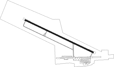
Kununurra
Airport details
| Country | Australia |
| State | Western Australia |
| Region | YB |
| Airspace | Brisbane Ctr |
| Municipality | Kununurra |
| Elevation | 145ft (44m) |
| Timezone | GMT +8 |
| Coordinates | -15.78273, 128.70987 |
| Magnetic var | |
| Type | land |
| Available since | X-Plane v10.40 |
| ICAO code | YPKU |
| IATA code | KNX |
| FAA code | n/a |
Communication
| Kununurra AWIS | 135.700 |
| Kununurra CTAF | 127.000 |
Nearby beacons
| code | identifier | dist | bearing | frequency |
|---|---|---|---|---|
| KU | KUNUNURRA NDB | 0.3 | 259° | 221 |
| KU | KUNUNURRA VOR/DME | 0.4 | 351° | 116.50 |
| ARG | ARGYLE VOR/DME | 53.1 | 197° | 113.90 |
Instrument approach procedures
| runway | airway (heading) | route (dist, bearing) |
|---|---|---|
| RW12-Z | KNXWD (100°) | KNXWD 3100ft KNXWI (5mi, 51°) 3100ft |
| RW12-Z | KNXWE (120°) | KNXWE 3100ft KNXWI (5mi, 119°) 3100ft |
| RW12-Z | KNXWG (140°) | KNXWG 3100ft KNXWI (5mi, 190°) 3100ft |
| RNAV | KNXWI 3100ft KNXWF (5mi, 119°) 1780ft YPKU (6mi, 121°) 191ft KNXWH (2mi, 113°) (7629mi, 277°) 3100ft | |
| RW30-Z | KNXEA (277°) | KNXEA 3100ft KNXEI (5mi, 231°) 3100ft |
| RW30-Z | KNXEB (298°) | KNXEB 3100ft KNXEI (5mi, 299°) 3100ft |
| RW30-Z | KNXEC (319°) | KNXEC 3100ft KNXEI (5mi, 10°) 3100ft |
| RNAV | KNXEI 3100ft KNXEF (5mi, 299°) 1790ft YPKU (5mi, 296°) 194ft (7627mi, 277°) 650ft KNXEH (7625mi, 97°) (7625mi, 277°) 3100ft |
Disclaimer
The information on this website is not for real aviation. Use this data with the X-Plane flight simulator only! Data taken with kind consent from X-Plane 12 source code and data files. Content is subject to change without notice.