Maclean - Palmers Island/maclean
Airport details
| Country | Australia |
| State | New South Wales |
| Region | YB |
| Airspace | Brisbane Ctr |
| Municipality | Clarence Valley Council |
| Elevation | 5ft (2m) |
| Timezone | GMT +11 |
| Coordinates | -29.44513, 153.26613 |
| Magnetic var | |
| Type | land |
| Available since | X-Plane v10.40 |
| ICAO code | YPLI |
| IATA code | n/a |
| FAA code | n/a |
Communication
| Palmers Island/Maclean CTAF | 126.700 |
Nearby Points of Interest:
Grafton Correctional Centre
-Grafton railway station, New South Wales
-Evans Head Memorial Aerodrome
-Grafton Bridge
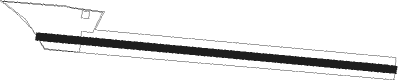
Runway info
| Runway 09 / 27 | ||
| length | 936m (3071ft) | |
| bearing | 98° / 278° | |
| width | 18m (59ft) | |
| surface | grass | |
| displ threshold | 33m (108ft) / 0m (0ft) | |
Nearby beacons
| code | identifier | dist | bearing | frequency |
|---|---|---|---|---|
| GFN | GRAFTON NDB | 22.6 | 217° | 389 |
| BNA | BALLINA NDB | 39.8 | 26° | 206 |
| CFS | COFFS HARBOUR VOR/DME | 53 | 189° | 117 |
Disclaimer
The information on this website is not for real aviation. Use this data with the X-Plane flight simulator only! Data taken with kind consent from X-Plane 12 source code and data files. Content is subject to change without notice.