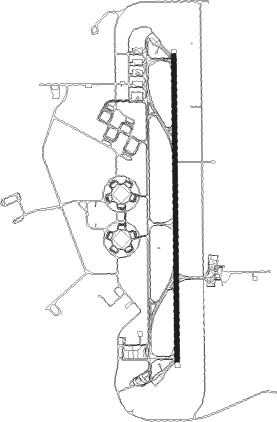
Learmouth (exmouth) - Learmonth
Airport details
| Country | Australia |
| State | Western Australia |
| Region | YM |
| Airspace | Melbourne Ctr |
| Municipality | Shire Of Exmouth |
| Elevation | 19ft (6m) |
| Timezone | GMT +8 |
| Coordinates | -22.24487, 114.08557 |
| Magnetic var | |
| Type | land |
| Available since | X-Plane v10.40 |
| ICAO code | YPLM |
| IATA code | LEA |
| FAA code | n/a |
Communication
| Learmonth CTAF | 118.300 |
| Learmonth Tower | 118.300 |
| Learmonth Approach | 120.500 |
Nearby Points of Interest:
Ningaloo Coast
-Vlamingh Head lighthouse
Nearby beacons
| code | identifier | dist | bearing | frequency |
|---|---|---|---|---|
| LM | LEARMONTH NDB | 0.6 | 72° | 396 |
| LM | LEARMONTH VOR/DME | 0.7 | 41° | 112.40 |
Instrument approach procedures
| runway | airway (heading) | route (dist, bearing) |
|---|---|---|
| RW18-Z | PLMND (164°) | PLMND 2300ft PLMNI (5mi, 112°) 2300ft |
| RW18-Z | PLMNE (185°) | PLMNE 2300ft PLMNI (5mi, 184°) 2300ft |
| RW18-Z | PLMNG (205°) | PLMNG 2300ft PLMNI (5mi, 255°) 2300ft |
| RNAV | PLMNI 2300ft PLMNF (5mi, 184°) 1740ft YPLM (7mi, 186°) 63ft PLMNH (1mi, 174°) (6738mi, 281°) 2300ft | |
| RW36-Z | PLMSA (341°) | PLMSA 2300ft PLMSI (5mi, 292°) 2300ft |
| RW36-Z | PLMSB (3°) | PLMSB 2300ft PLMSI (5mi, 4°) 2300ft |
| RW36-Z | PLMSC (26°) | PLMSC 2300ft PLMSI (5mi, 75°) 2300ft |
| RNAV | PLMSI 2300ft PLMSF (5mi, 4°) 1750ft YPLM (5mi, 2°) 69ft PLMSH (3mi, 9°) (6739mi, 281°) 2300ft |
Disclaimer
The information on this website is not for real aviation. Use this data with the X-Plane flight simulator only! Data taken with kind consent from X-Plane 12 source code and data files. Content is subject to change without notice.
