Adelaide - Adelaide Parafield
Airport details
| Country | Australia |
| State | South Australia |
| Region | YM |
| Airspace | Melbourne Ctr |
| Municipality | Adelaide |
| Elevation | 57ft (17m) |
| Timezone | GMT +9.5 |
| Coordinates | -34.78975, 138.63968 |
| Magnetic var | |
| Type | land |
| Available since | X-Plane v10.30 |
| ICAO code | YPPF |
| IATA code | n/a |
| FAA code | n/a |
Communication
| Adelaide Parafield ATIS | 120.900 |
| Adelaide Parafield CTAF | 118.700 |
| Adelaide Parafield PARAFIELD Ground Control | 119.900 |
| Adelaide Parafield PARAFIELD Tower | 124.600 |
| Adelaide Parafield AI ATC | 120.800 |
Nearby Points of Interest:
Yatala Labour Prison
-Dry Creek explosives depot
-North Road Cemetery
-Port Adelaide Lighthouse
-Torrens Parade Ground
-Bonython Hall
-Government House
-State Library of South Australia
-Parliament House of South Australia
-Beehive Corner
-Attunga
-Adelaide Town Hall
-Queen's Theatre
-Torrens Building
-Angle Vale Bridge
-Benacre
-Happy Valley Reservoir
-Clarendon Weir
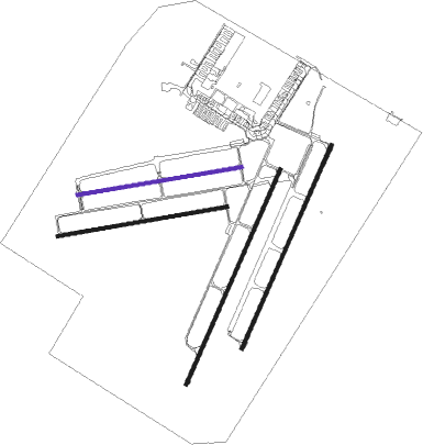
Runway info
Runway 03L / 21R  | ||
| length | 1352m (4436ft) | |
| bearing | 33° / 213° | |
| width | 18m (59ft) | |
| surface | asphalt | |
| blast zone | 32m (105ft) / 0m (0ft) | |
| Runway 03R / 21L | ||
| length | 1281m (4203ft) | |
| bearing | 33° / 213° | |
| width | 18m (59ft) | |
| surface | asphalt | |
| Runway 08R / 26L | ||
| length | 991m (3251ft) | |
| bearing | 86° / 266° | |
| width | 18m (59ft) | |
| surface | asphalt | |
| Runway 08L / 26R | ||
| length | 957m (3140ft) | |
| bearing | 86° / 266° | |
| width | 18m (59ft) | |
| surface | asphalt | |
Nearby beacons
| code | identifier | dist | bearing | frequency |
|---|---|---|---|---|
| PF | PARAFIELD (ADELAIDE) NDB | 0.5 | 232° | 416 |
| EDN | EDINBURGH (ADELAIDE) TACAN | 5.2 | 342° | 110.30 |
| AD | ADELAIDE VOR/DME | 11 | 216° | 116.40 |
Instrument approach procedures
| runway | airway (heading) | route (dist, bearing) |
|---|---|---|
| RW21R | PPFNA (187°) | PPFNA 4000ft PPFNI (5mi, 133°) 3000ft |
| RW21R | PPFND (236°) | PPFND 4000ft PPFNI (5mi, 277°) 3000ft |
| RNAV | PPFNI 3000ft PPFNF (5mi, 213°) 1690ft YPPF (5mi, 213°) 99ft (7691mi, 284°) 500ft PPFNH (7686mi, 104°) (7686mi, 284°) 3000ft |
Disclaimer
The information on this website is not for real aviation. Use this data with the X-Plane flight simulator only! Data taken with kind consent from X-Plane 12 source code and data files. Content is subject to change without notice.