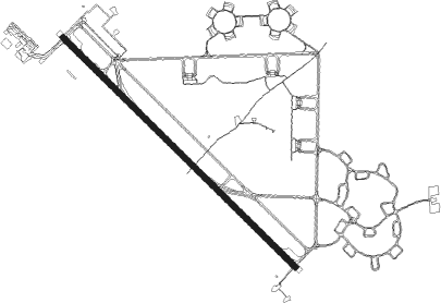
Tindal (military)
Airport details
| Country | Australia |
| State | Northern Territory |
| Region | YB |
| Airspace | Brisbane Ctr |
| Municipality | Town of Katherine |
| Elevation | 442ft (135m) |
| Timezone | GMT +9.5 |
| Coordinates | -14.52034, 132.38417 |
| Magnetic var | |
| Type | land |
| Available since | X-Plane v10.40 |
| ICAO code | YPTN |
| IATA code | KTR |
| FAA code | n/a |
Communication
| Tindal (Military) BRISBANE CENTRE MULT | 122.600 |
| Tindal (Military) TINDAL MULT | 119.700 |
| Tindal (Military) TINDAL (MILITARY) CLD | 128.100 |
| Tindal (Military) TINDAL Ground Control | 135.850 |
| Tindal (Military) TINDAL Tower | 119.700 |
| Tindal (Military) TINDAL Approach | 121.900 |
| Tindal (Military) TINDAL Approach | 130.100 |
| Tindal (Military) TINDAL TRAFFIC Approach | 125.800 |
Approach frequencies
| ILS-cat-I | RW14 | 110.7 | 18.00mi |
| 3° GS | RW14 | 110.7 | 18.00mi |
Nearby beacons
| code | identifier | dist | bearing | frequency |
|---|---|---|---|---|
| TDL | TINDAL (KATHERINE) TACAN | 0.6 | 254° | 112.30 |
| TN | TINDAL (KATHERINE) VOR | 0.7 | 275° | 112.30 |
| TN | TINDAL (KATHERINE) NDB | 1.4 | 281° | 356 |
Departure and arrival routes
| Transition altitude | 10000ft |
| Transition level | 11000ft |
| SID end points | distance | outbound heading | |
|---|---|---|---|
| RW14 | |||
| DAPMA2 | 137mi | 95° | |
| MIGAX3 | 150mi | 126° | |
| MILIV4 | 150mi | 143° | |
| DOSAM4 | 151mi | 161° | |
| GREGA4 | 151mi | 171° | |
| LARAB4 | 238mi | 308° | |
| RW32 | |||
| DAPMA2 | 137mi | 95° | |
| MIGAX3 | 150mi | 126° | |
| MILIV4 | 150mi | 143° | |
| DOSAM4 | 151mi | 161° | |
| GREGA4 | 151mi | 171° | |
| LARAB4 | 238mi | 308° | |
Instrument approach procedures
| runway | airway (heading) | route (dist, bearing) |
|---|---|---|
| RW14-Z | PTNND (117°) | PTNND 2300ft PTNNI (5mi, 69°) 2300ft |
| RW14-Z | PTNNE (137°) | PTNNE 2300ft PTNNI (5mi, 138°) 2300ft |
| RW14-Z | PTNNG (157°) | PTNNG 2300ft PTNNI (5mi, 210°) 2300ft |
| RNAV | PTNNI 2300ft PTNNF (5mi, 138°) 2160ft YPTN (6mi, 135°) 478ft PTNNH (2mi, 149°) (7852mi, 276°) 2300ft | |
| RW32-Z | PTNSA (299°) | PTNSA 2300ft PTNSI (5mi, 249°) 2300ft |
| RW32-Z | PTNSB (319°) | PTNSB 2300ft PTNSI (5mi, 318°) 2300ft |
| RW32-Z | PTNSC (340°) | PTNSC 2300ft PTNSI (5mi, 30°) 2300ft |
| RNAV | PTNSI 2300ft PTNSF (5mi, 318°) 2170ft YPTN (6mi, 322°) 492ft PTNSH (2mi, 309°) (7850mi, 276°) 2300ft |
Disclaimer
The information on this website is not for real aviation. Use this data with the X-Plane flight simulator only! Data taken with kind consent from X-Plane 12 source code and data files. Content is subject to change without notice.